Persistent weak layer problem: isolated danger zones, esp. on very steep shady slopes
Our snowpack analysis and reports from winter sports enthusiasts confirm a persistent weak layer, continually diminishing yet in isolated cases still evident and, all in all, quite delicate to discern. Avalanche prone locations are found especially on very steep shady slopes above about 2200 m, but also on sunny slopes at high altitude. Avalanche triggerings are possible, particularly in transition zones from shallow to deep snow. The fractures mostly occur at mid-level inside the snowpack.
 |
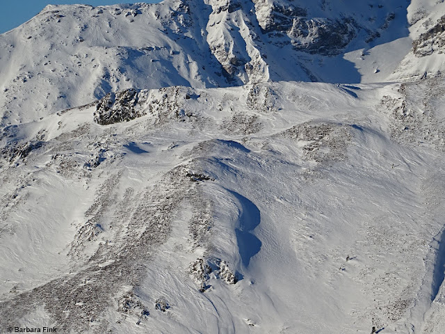
| Very isolated: slab released by remote triggering. The highly varied snow depths are typical, and fascinating. Glockner Massif. (photo: 15.12.2021 (c) Toni Riepler) |
 |
| Following large additional loading by freshly generated drifts, a naturally triggered avalanche due to stormy winds. Central East Tirol. (photo: 20.12.2021) |
Two reports reached us this week about naturally triggered slab releases in which fractures occurred in ground-level weak layers on glacial ice. One was on the Manigenbachkogel in the Gurgler Massif at 3200 m, NE; another was below the Gabler in the Zillertal Alps at 2850 m, NW. Also in this case, the loading of the fresh snowdrifts was probably the trigger. Comparisons to the avalanches in the beginning of November in glacier zones, but also in our last Blog about the avalanche on the Linker Fernerkogel.
Persistent weak layer usually easy to recognize
What marked last week was the weather: at high altitudes often storm-strength winds, usually northerly or westerly.
 |
| Weather station St. Veit Zischke in Defereggental. Stormy winds on 20.12.2021. The result: snow transport even below the timberline. Aside from that it was generally sunny. |
 |
| Wind impact led to highly irregular snow distribution. Sattelberg. (photo: 16.12.2021) |
 |
| Cornices in the Zillertal Alps (photo: 19.12.2021) |
The snowdrift problem is currently limited to steep terrain and there, especially behind protruberances. Ridgeline terrain is also at risk. With some experience in on-site avalanche assessment, such danger zones can easily be recognized and circumvented. Caution urged particularly where fresh drifts were deposited on surface hoar or thin melt-freeze crusts (with loose crystals beneath them) since they are easy to trigger.
Only isolated glide-snow avalanches
 |
| After intense glide-snow activity around 13.12, glide-snow avalanches are now being reported only rarely. Carnic Alps (photo: 16.12.2021) |
Snow quality: frequently poor
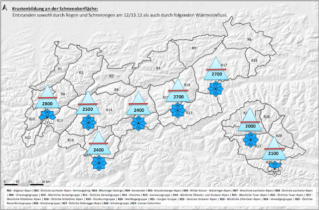
The snowpack surface was recently subjected to high wind impact, at least above the treeline. In addition, due to rain impact (12-13.12.2021) and subsequent solar radiation, a thin melt-freeze crust was generated widespread, dampening skiers’ enthusiasm. In some places, e.g. Carnic Alps, the thin rain crust on shady slopes has now been transformed to loose crystals. Wherever there was no wind, conditions in the Carnic Alps are better.
 |
| Melt-freeze in the Lechtal Alps (photo: 20.12.2021) |
 |
| Rough overview of crusts on the snowpack surface. All the reports we received have been fed into this overview, and added to snow profiles. In inneralpine zones such as southern East Tirol the altitudes lie somewhat lower. On sunny slopes, however, they also occur at higher altitudes there. |
 |
| In some places there is just not enough snow for good skiing. Northern Stubai Alps (photo: 14.12.2021) |
Surface hoar
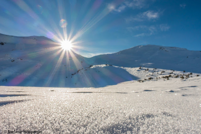
What is fascinating to us is the increased formation of surface hoar: similar to superficial crusts, evidently widespread, at least below the timberline, but on shady slopes and in flat terrain also above it. It seems to have formed predominantly at the fogbank borderlines (15.12.2021).
 |
Surface hoar: visually beautiful, but dangerous when covered with snow or snowdrifts.
Grubenkopf, Central Stubai Alps (photo: 14.12.2021) |
 |
| At the fogbank borderline, a narrow band of surface hoar tends to form. (photo: 16.12.2021) |
 |
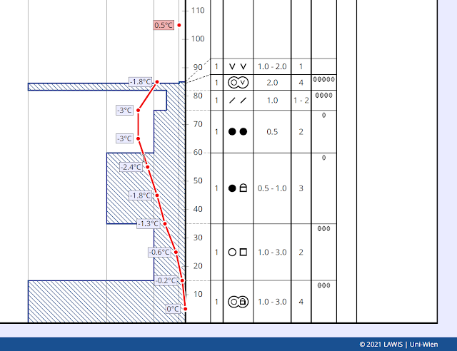
| Very instructive: surface hoar; below that a thin melt-freeze crust; below that a thin layer of loose crystals. Salfeins. 2000m, E. Profile from 15.12.2021 (c) Anna Siebenbrunner |
Since the structure of the snowpack surface plays a decisive role in the ongoing development of avalanche danger levels, we are grateful for information about the character of the snowpack surface, particularly observations about melt-freeze crusts and surface hoar (with accompanying data of altitude and aspect). Please send information via mail to: lawine@tirol.gv.at.
Outlook for the holidays
The ZAMG Weather Service describes the current weather situation this way: “The Alps are in the grip of a northwesterly air current which will be brushed by a warm front bringing warmer air masses. In the wake of this front, a westerly air current will bring mild but not overly moist air masses our way.”
That means that no significant changes are to be immediately expected in the avalanche situation. New avalanche prone locations will be generated in particular where the thin crusts and surface hoar which currently compose the snowpack surface get blanketed by fresh snow.
MERRY CHRISTMAS!
On behalf of the entire team at the Avalanche Warning Service of Tirol, we send you our very best wishes for a Happy Christmas.
 |
| One of Tirol’s many power spots for contemplative holidays. (photo: 23.12.2021) |


