Thursday 29 April 2021

Rather unfavorable avalanche conditions, frequently poor snow quality

Snowpack becoming increasingly wet - Likelihood of naturally triggered avalanches rising


Over the last few days it was quite warm, amid variable weather conditions. The snowpack became ever moister, also at high altitudes, thoroughly wet even down to lower layers. In the southern regions this was not the case, due to temporarily poor weather. It was similar in parts of North Tirol last night (28.04-29.04) where outgoing longwave radiation of the snowpack was severely reduced regionally.


Web camera photos aid evaluation of nighttime cloud cover


Avalanche releases have been limited. Mostly they were (isolated) wet loose-snow avalanches.


Loose-snow avalanxches near Zuckerhütl in the Stubai Alps (photo: 23.04.2021)


On Sunday, 25.04, warm temperatures made the snowpack on shady slopes thorougly wet. Thereby, some loose-snow avalanches were activated in extremely-steep terrain. (Griesskogel Massif)


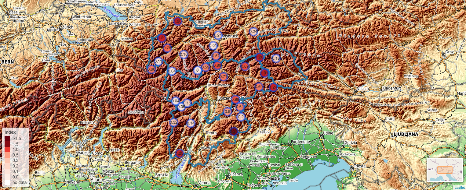
Since yesterday (28.04) there have again been naturally triggered avalanches observed. This seems to be a sign that naturally triggered avalanche activity will increase in the next few days. This will strike the shady slopes most of all, particularly where the snowpack is not yet thoroughly wet. Currently we foresee an altitude band at 2400 m with certain disparities upwards and downwards. But there is potential for slab avalanches also on sunny slopes. Fractures could occur increasingly in the near-surface layers. There, a melt-freeze crust, which is deposited atop loose, wet, melt-freeze forms, could provide the requisite slab.


Naturally triggered slab avalanche at 2300m, in rear Pitztal near a moraine (photo: 28.04.2021)


Visible in the photo: melt-freeze crust still capable of bearing loads, beneath that a thoroughly wet, loose layer: a potential weak layer for slab avalanches. Kaunertal. (photo: 28.04.2021)


Glide-snow avalanche on shady slope at 1600m, Tannheimertal (photo: 28.04.2021)


Snow quality is currently poor, by and large. Only above about 2700/2800m does it improve.


A thin line between “fracture” / breakable melt-freeze crust / capable of bearing loads. Spots where you break through are becoming more frequent. (photo: 28.04.2021)


Short review


Last week was truly April weather, fully variable. In North Tirol the conditions were more pleasant than in East Tirol - due to foehn influence. It was really good on the weekend, in particular on Saturday, 24.04, when a short thrust of dry air penetrated the land. In spite of warmer temperatures the snowpack was hardly weakened. Favorable conditions dominated, complete with daily daytime avalanche danger cycle.


The best day last week was surely Saturday, 24.04. The dry air masses are visible. The snowpack had adequate outgoing longwave radiation during the nocturnal hours. In the interim the snowpack has become wet, melting point 0°. Water can now seep unhindered into the lower layers.


A similar picture from Eselrücken in northern East Tirol.

According to ZAMG Weather Service forecasts, the month of April numbers among the coolest Aprils since 1997 and is one of the eight driest in the history of weather measurement (since 1858!).


Outlook for the next few days


Between today, 29.04, and tomorrow, 30.04, a weak cold front will traverse the land, according to ZAMG Weather Service. Temperatures will drop about 1-2°. In the mountains a strong-velocity foehn wind will prevail in the foehn lanes. Variable conditions will persist on Friday, 30.04. It could prove to be a ‘steamy’ day with lots of diffuse radiation which will reinforce the process of snowpack moistening. On 01.05 conditions will part ways: pleasant in the north, less so in the south. Still mild. On Sunday, 02.05, a cold front will send temperatures significantly lower. Snowfall level in the southern regions will be higher than in the north, between 1200 and 2000 m. Fresh snow: about 20-30 cm in the mountains. The wet-snow threat will briefly recede. But at high altitudes, mostly near ridgelines, a snowdrift problem will prevail, even if limited.


12-hr fresh snow forecast  29.04. - 30.04.2021


Thursday 22 April 2021

Springtime conditions, heightened increase in avalanche danger, good timing more important than ever!

A sunny weekend awaits us. Caution towards wet-snow avalanches during course of day!


Following a typical variable period of April weather bringing us rainfall regionally up to 2000m in many northern regions, today on 22.04 weather conditions are now improving. During the night, skies will begin to clear. On Friday and Saturday, sunny and warm days are promised ahead. On Sunday, 25.04, convective cloud build-up could bring a bit of precipitation.


Last week was cold and variable. View from the Tux Alps towards the Karwendel
(photo: 22.04.2021) 


Caution: daytime increase in avalanche danger


Warm temperatures and intensive solar radiation will weaken the snowpack to an increasing degree over the next few days. Sunny and shady slopes need to be examined separately.


Sunny slopes

On sunny slopes the near-surface layers (deposits from 05.04.2021) are forfeiting their firmness. These weak layers are found esp. above the recently formed melt-freeze crusts. Water seepage due to the melting process can lead to a raised proneness to triggering of the snowpack, including naturally triggered avalanches. Also possible: triggering of slab avalanches through the impulse of a wet loose-snow avalanche in extremely steep terrain.


Naturally triggered slab avalanche on 21.04, afternoon, on a south-facing slope at about 2500m in the Stubai Alps. A wet loose-snow avalanche was the possible triggerer. The slab fractures on a melt-freeze crust which formed starting on 12.04, on which dust from the Sahara desert was deposited on 12 April.
(photo: 21.04.2021) 


High-alpine sunny slopes are also hit by this.


A slab triggered remotely at 3000 m on a south-facing slope in Granatspitz Massif (photo: 21.04.2021)


Also needful of attentiveness: isolated glide-snow avalanches on steep, smooth ground (mostly glide-snow avalanches released during the intensive phase of warmth at the end of February or end of March).
Stubai Alps, 20.04.2021


A typical sunny-slope profile at high altitude. Above a thick melt-freeze crust which formed starting on
3 April, a sequence of thin crusts and weak layers resulting from water seepage.
2130m, west, Tux Alps, 21.04.2021


North-facing slopes


North-facing slopes were moistened deeply up to 2400m in North Tirol, up to 2000m in East Tirol, this winter. This occurred on 2 April when it rained. Numerous naturally triggered avalanches, increasingly frequent as wet loose-snow avalanches, also as slab avalanches, were the result. With today’s rain input (22.04.2021) and the huge diffuse radiation at the beginning of the day, the snowpack in the northern regions was again moistened, at least superficially.


Precipiation on 22.04.2021 up to 19:00 Uhr


Temperature reserves hardly exist anymore. Warmth and diffuse radiation can thus lead to deeply penetrating water seepage. This will weaken the snowpack, making the snowpack easier to disturb by winter sports enthusiasts, but also leading to increased naturally triggered avalanches.


Snow profile NE 2335m shows a rather flat temperature progression (doubtless flattened further today, 22.04). Noteworthy: the ground-level, slightly encrusted layer. Particularly in spots where snow was shallow at this altitude, we can assume a thoroughly wet snowpack as of Saturday late afternoon. The results could be slab avalanches which fracture at ground level.


On shady slopes, superficial loosely-packed snow avalanches currently, also below 2400 m;
also slab avalanches possible in the course of the day. (photo: 21.04.2021)


Snowpack, a snowpack simulation model used by us, shows that the snow cover over the next few days on north-facing slopes will become thoroughly wet down to ground level: pink dots below right below in the left depiction. Right: simulated profile on Gallreideschrofen in  Gschnitztal: superficially, melt-freeze crusts dominate; at ground level, expansively metamorphosed layers.


Overview of simulated “avalanche activity indices” for today, 22.04.2021, 3:00 pm.
“1” denotes increasing weakness.


For comparison: forecast for Saturday, 24.04, 3:00 pm


Equally noteworthy: in the Zillertal Alps along the Main Alpine Ridge, naturally triggered avalanches were registered in extremely steep north-facing slopes at 3000m. Moment of release is not yet certain, probably very recently. The fractures were apparently rather large. This needs to be coordinated with other observations, since other winter sports enthusiasts also reported on high-altitude, wind-protected zones.


In early morning, mostly favourable conditions. Caution: danger of falling.


As clear nights freeze the near-surface layers of the snowpack, we assume a melt-freeze crust capable of bearing loads on sunny slopes below 2200m in the early morning hours, at least at high altitudes. Caution: in steep terrain there is a huge danger of falling. Melt-freeze spikes and climbing spikes ought to be part of every rucksack’s equipment.


Conclusion: plan your time carefully.


In the coming days, careful tour planning, especially good time planning, is highly important. Avalanches can release increasingly easily over the course of the day as the snowpack becomes moister - whether triggered by skiers or triggering naturally. Particular caution is required on shady slopes below 2400m, where slab avalanches can fracture increasingly at ground level. In this connection, southern East Tirol has a far better situation, where the snowpack fundament is compact.

IF you plan your time carefully, you will be rewarded by fantastic firn snow.

Monday 19 April 2021

After dreamlike powder, now heightened caution on shady slopes

Diffuse radiation raises likelihood of triggering on shady slopes - Caution urged esp. at 2200-2600m


As was amply evident in the most recent blogs, it was possible to savor superb powder snow in many areas on shady slopes amid low temperatures last week. As of today, 19.04, the sun appeared frequently between the clouds. This, in turn, led to heightened diffuse radiation impact, and on the other hand, to a superficial bonding of the powder snow to the snowpack. In a nutshell: a slab formed.


View from Seegrube towards the south. In afternoon, mostly scattered clouds and a bit of sunshine.


Slab avalanches can always release when there is a weak layer and a slab. A weak layer with good fracture propagation can currently be found on north-facing slopes in a narrow altitude band of 2200-2600m. There, at the beginning of April due to rain impact, a thin melt-freeze crust formed. This was generated atop a thin layer of faceted crystals, ergo, the potential weak layer.


Naturally triggered slab avalanche below Sommerwand in the Stubai Alps.
North, 2400m. Time of release: 19.04.2021, 1:15 pm


Caution urged esp. in regions in North Tirol where there has recently been heavy snowfall


This applies to North Tirol and there, to the regions where there was the most snowfall between 12.04 and 13.04. To be precise: Tux, northern Zillertal, eastern Stubai and Ötztal Alps, Karwendel,  Mieming Massif.


24-hr-snow differences from 12.04. to 13.04.2021


Our estimate is based on reports and observations received today (19.04). We received reports of naturally triggered slab avalanches in Stubai and Zillertal Alps during the afternoon in this altitude band. Initially, we assume heightened proneness to triggering of the snowpack there.


Also on sunny slopes: a treacherous situation from place to place


Depending on radiation impact and daytime warmth, even sunny slopes could be more prone to triggering tomorrow (20.04) in the regions referred to above and in southern East Tirol. Over the coming weekend, with fine weather and increasing temperatures forecast, it promises to become exciting on sunny slopes. We will report more on this on Thursday, 22.04.2021 at latest.

Sunday 18 April 2021

Avalanche accident Grosser Zunig (East Tirol): one fatality, one severe injury

At 1.00 pm on 17.04 Headquarters Tirol received an emergency call about an avalanche accident on Grosser Zunig south of Matrei in East Tirol. Two backcountry tourers were caught by a slab during their descent and swept over rocky terrain. One person died at the scene of the accident, the second person was flown to the Innsbruck Clinic with grave injuries.


The red ellipse marks the scene of the accident north of Grosser Zunig. At the upper edge is Matrei in Osttirol (c) tiris


The slab triggered in extremely steep terrain on a north-facing slope at about 2550m altitude. The release was caused by a surface-layer snowdrift problem due to recent strong-wind impact. On-site inspection is not planned due to current weather developments and the highly exposed nature of the terrain.


Arrow marks the entry zone (photo: 17.04.2021)


Two entry tracks into the slab. Fracture depth varies, estimated between 30 cm and 70 cm.
(photo: 17.04.2021) 


Arrow marks the upper rim of the slab fracture. (photo: 17.04.2021)


Additional information about the current situation

We have received new reports and observations about the formation of dp.4 (cold on warm). It occurs in sunny very steep terrain starting at about 2200m in particular. One exception was registered in the Stubai Alps: a south-facing slope at 2050m. Settling noises are a frequent indicator for this old-snow problem.

Snow quality is currently poor in sunny terrain. Breakable melt-freeze crusts dominate.

Over the last few days, many descents have been made on north-facing slopes, also in extremely steep terrain. This shows that avalanche prone locations are not highly prevalent on north-facing slopes.

Problem zones on north-facing slopes are most likely in North Tirol in a narrow altitude band around 2300m. In that zone a thin rain crust formed on 2 April, beneath that a thin layer of faceted crystals which formed during the phase of fine weather until the beginning of April,
  • in spots of shallow snow at high altitudes where there are nests of depth hoar
  • in the form of freshly generated snowdrift accumulations in extremely steep terrain

Friday 16 April 2021

Much powder currently, quite good conditions. Locally, treacherous avalanche situation expected (dp.4 – cold on warm)

 New weak layers possibly forming

The recent instable weather with its immense temperature fluctuations is giving us a headache. The reason: it provides perfect prerequisites for Danger Pattern "cold on warm" (dp.4). This syndrome is known for forming weak layers inside the snowpack after a certain post-snowfall period. As of today, 15.04.2021, we have evidence which points to this threat: in the Glockner Massif, settling noises were reported on sunny slopes above 2700m. On Tschadinhorn in the Schober Massif a southwest-facing gully triggered a 100m long and equally wide slab avalanche at 2700m due to additional loading. Not far from Tirol, in the Sesvenna Massif, signs point to a near-surface weak layer being particularly prone to triggering, particularly at high altitudes on sunny slopes. Recollections of a similar situation  come to mind. 

Evidence is still lacking to what extent shady terrain is being visited by this development. The fact is, at least the snowpack on north-facing slopes was moist up to high altitudes last weekend and was blanketed over by cold fresh snow.


A slab triggering due to loose-snow avalanche. Type of weak layer unknown.
2700m north, Lüsener Villerspitze


Since the beginning of this month, alternating warm and cold phases have dominated. 


Marked temperature disparities this week. To start with, cold; then warm as snowpack surface moistened; then cold again with the snowfall. Above, one of the stations with the greatest amounts of fresh snow measured. Franz-Senn-Refuge in the Stubai Alps.


Similar in southern regions. There, winds were stronger. Zischke station im Defereggental


24h-differences in snow depths on 12–13 April 2021


One of the spots where snowfall was heavy last week: Halltal in the Karwendel. (photo: 14.04.2021) 


A frequent companion during snowfall: graupel. Gleirschtal in northern Stubai Alpls.
(photo: 12.04.2021)


Problem zones in near-surface layers


In order for a slab to form you need not only a weak layer, but also a bonded snow mass on top of it. The latter is found frequently at high altitudes due to short periods of wind impact, but also on sunny slopes where the snowpack slowly settles and condenses due to solar radiation in spite of low temperatures. What is currently important: we are faced with near-surface problem zones. Potential weak layers: either faceted crystals (due to dp.4, briefly loose, blanketed powder) or massive layers of embedded graupel locally.


In this profile the slab is lacking. The fresh snow is loosely-packed. Potential weak layers:
graupel and the faceted crystals near the surface (above arrow).


A quite thin slab above a thin, loose weak layer (arrow symbolizes the potential near-surface problem zone). Also interesting, the temperature leap near the surface: short solar radiation led to snowpack moistening a few cm beneath the very loose surface, so-called “radiation recrystallisation.”


Main concentration in marked zone. Easily visible: the layer of Sahara dust from the beginning of February. Jamtal, Silvretta. (photo: 14.04.2021)


Indicative of ridgeline high-altitude terrain: wind impact with snowdrift accumulations
on both shady and sunny slopes.


Still lots of good powder


Despite the above considerations and developments which are devilishly hard to evaluate, we also have to focus on the fantastic powder snow of last few days.


A powder dream-come-true in the Gurgler Massif. Hinterer Seelenkogel (photo: 14.04.2021)


Similar situation in the Jamtal (photo: 14.04.2021)


Numerous loose-snow avalanches


Loosely-packed powder snow reinforces a heightened likelihood of loose-snow avalanches triggering at this juncture of the season. The below-average temperatures slow down this activity somewhat, but numerous loose-snow avalanches were observed particularly on 13.04 and 14.04.


Deposits of freshly triggered loose-snow avalanches. Northern Stubai Alps (photo: 14.04.2021)


Caution: cornices


Another danger lurks in ridgeline terrain: cornices. Do not underestimate them! Grossglockner
(photo: 15.04.2021)


Outlook


It will remain cool. An intermediate high will bring sunshine on Friday, 16.04, and Saturday, 17.04, at least. Thereafter a northern air current will keep things unstable. Initially, not much will change in the avalanche situation. We assume quite favorable conditions at least at low and intermediate altitudes; and a treacherous situation at high altitudes from place to place. Solar radiation will reinforce bonding of the near-surface layers.

Incidentally, stability tests of near-surface layers conducted by persons who know how to conduct them can help us track down weak layers. We are interested in such observations. Please send the results (including altitude) directly to our headquarters: lawine@tirol.gv.at - Thank you for your support.


Only a few lifts are still open.


Dream-come-true conditions, such as here in Kühtai ski area, open until Sunday, 18.04
(photo: 14.04.2021)

Thursday 8 April 2021

Main danger: fresh drifts and loose-snow avalanches

Temperature progression...far removed from normal


Yes, this is April, and April is well known for capricious weather. Even taking that into consideration, we gaze back on a highly ususual sequence of temperature development. Let’s permit an expert at ZAMG Weather Service, Alexander Radlherr, to elucidate just what happened: 

“The ups and downs in temperature were rather extreme this year. A week ago, just days after the latest striking re-entry of winter, record-breaking high temperatures were registered in many measurement stations in Tirol (including those with long meauring histories) for the month of March. On 07.04.2021 at some stations, a short series of record-breaking lows for April was reached. On the same days of April 2003 it was 1 to 2 degrees colder at high altitudes, although these were absolute record lows for the month of April at many of the ‘old’ measuring stations.

Tmax from 31.03.2021:
Innsbruck +25.5; measurements since 1877
Umhausen +21.5, measurements since 1936
Brunnenkogel +3.1, measurements since 2003
Tmin vom 07.04.2021:
Brunnenkogel -24.6 (old record -22.5 from 2015)
Just let that sink in. The huge extremes this winter were not merely a subjective feeling.”


Deviation of daily mid-temperature on 30.03.2021 (in the mountains this depiction shows a still more striking Maxima than on 31.03)


Deviation from daily middle temperature on 07.04.2021


Effects on avalanche danger


To begin with, a wet-snow problem...


Until and including 02.04.2021 we were in a wet-snow avalanche cycle. At the middle of last week there were extremely warm temperatures measured, amplified by the effects of solar radiation, which were the cause of this. On 02.04, nocturnal rainfall and moist-warm weather accelerated snowpack moistening, particularly on shady slopes. The snowfall level varied starkly, fluctuating between 1800 and 2400m.


Rain distribution in Tirol on 01 - 02 April, thereby eliminating most of the nighttime outgoing radiation and creating faster moistening of the snowpack on shady slopes on 02.04.2021


In isolated cases, even thunder and lightning, like here in the Brandenberg Alps (photo: 02.04.2021)


For the first time this winter, the snowpack on shady slopes at altitudes between 2000 and 2200m (in some places higher) was utterly, thoroughly wet and weakened. In those zones, frequent moist-to-wet loose-snow avalanches triggered. Only in isolated cases did we observe slab avalanches. One of these loose-snow avalanches buried the road to the Sulztalalm in the Ötztal where a sledder was on his way uphill. The person was buried by the avalanche and was able to be rescued only 5 hours later when an avalanche dog located him. A large air cavity permitted him to survive for such a long time in the avalanche. In the interim, the person has been released from the hospital.

Overview of starting zone of the loose-snow avalanche in the Sulztal (photo: 02.04.2021)


Arrow points to the spot the person was buried (photo: 02.04.2021)


Other photos of loose-snow avalanches on 02.04.2021


Loose-snow avalanche on 02.04 on the way to Vennspitze in northern Zillertal Alps (photo: 06.04.2021)


Loose-snow avalanche on 02.04 in Nauderer mountains (photo: 08.04.2021)


Starting on 03.04, conditions stabilized. And then a local snowdrift problem developed, reinforced by expanding Danger Pattern cold-on-warm (dp.4).


When on Holy Saturday, 03.04, temperatures kept dropping, the wet-snow problem suddenly became irrelevant. The snowpack stabilized. On Easter weekend on sunny slopes there was often good firn snow forecast (amid low temperatures). Only as a cold front brought plummeting temperatures on Easter Monday, with strong winds and, in the northern regions increased snowfall, did the snowdrift problem then become a big worry.


One of the regions where there was most snowfall since Easter Monday: Ulmer Refuge in the Arlberg region. Temperature crash and stark wind influence are visible.


72-hr snow differences in Tirol. Most snowfall was registered in the northern regions.


Increasingly involved were the northern regions where snowfall was heaviest. And there, particularly in ridgeline, very steep, sunny terrain and generally in shady terrain, especially at altitudes between 2000 and 2500m, great caution was necessary. This can be explained by the extremes of temperature at the borders of old and fresh snow (previously a thoroughly wet snowpack, and then fresh snow including plummeting temperatures) which created faceted/decomposed crystals (Danger Pattern 4: cold on warm). This snow currently constitutes a potential weak layer for recently generated snowdrift accumulations.

The advantage: with some experience, these snowdrift accumulations can be easily recognized in outlying terrain and thus, circumvented. Further to the south the snowdrifts are more shallow. In addition, the increasing solar radiation and rising temperatures will swiftly eradicate this problem before long.


Easily recognizable, although in this case the drifts are shallow. Nauderer mountains (photo: 08.04.2021)


Near to the surface is a thin, weak layer of faceted/decomposed crystals which formed over the last few days. SE, 2650m, Nauderer mountains


Depiction similar to the one above: near-surface weak layer. Irrelevant in this case, since there is no slab atop it. North, 2350m, Nauderer mountains


Here, weak layer lies beneath a thin melt-freeze crust which formed on 02.04. North, 2440m, Stubai Alps


Short-term loose-snow avalanches...


In addition, increasingly frequent loose-snow avalanches can be expected in particular on the morning of 09.04. Solar radiation and rising temperatures will lead to the uppermost layers becoming moist / wet, thereby destabilizing the near-surface layers.


What’s next...


By the weekend, high-pressure weather conditions and mild temperatures will again take the forefront. Avalanche danger will recede, the daily cycle of avalanche danger will again be in the spotlight. All in all, quite favourable conditions will reign.


A short-lived pleasure: powder snow atop a hardened snowpack surface. (photo: 08.04.2021)