Friday 31 January 2020

Avalanche on Neunerkogel in open skiing terrain near Kühtai

Today, 31.01, at 1:46 pm headquarters in Tirol reported an avalanche on Neunerkogel south of Kühtai. A slab avalanche triggered in extremely steep terrain as one person was  in the descent.

The arrow and ellipse show the area of the avalanche. In the foreground is the Finstertal Reservoir. To the north, Kühtai is visible.

The person was swept along by the avalanche. According to latest information, that person was rescued and flown with grave injuries to the hospital in Innsbruck.

The avalanche released on a rocky W/NW-facing slope. Altitude of the primary point of fracture was about 2550 m. An additional slab avalanche subsequently triggered in the plummet path. What was decisive for the release was the recently fallen and transported snow which was deposited on a weak layer. In all likelihood the weak layer was the expansively metamorphosed (faceted) snow from the extended period of beautiful weather (see last blog and the snow profile in it).

Here are some overview photos, given to us by the Alpine Police:

Overview photo of the slab avalanche. The entry track, the first (narrow) slab avalanche and the second (wider) slab avalanche below the rocks are visible. (photo: 31.01.2020)

Entry track including primary slab. (photo: 31.01.2020)

Above left, a part of the plummet path of the primary avalanche. Secondarily, another slab avalanche released. (photo: 31.01.2020)

The snow profile made yesterday, 30.01, on an east-facing slope of Hohe Mute just across from the avalanche is interesting in this connection. Other profiles can be found here:

Significant for the “excellent artificial triggerings” referred to in the profile is the layer embedded between crusts consisting of faceted, loose crystals. On top of that are snowdrifts and fresh snow.


Thursday 30 January 2020

Regionally critical situation for winter sports enthusiasts

New danger zones due to fresh snow and wind

A cold front passed through on Tuesday, 28.01, brought more than 50 cm of fresh snow regionally during Wednesday night 29.01.

Most of the snow fell in northwestern Tirol and northern East Tirol.

Weather last week. To begin with, high-pressure conditions, then weakening. Initially southerly airstream, then cold air masses moved in, winds shifted to N/NW and brought snowfall. The “Am Adamsberg” station above Galtür in Paznauntal.

High avalanche danger for a brief spell

Avalanche danger levels increased correspondingly, danger level 4 (“high”) was declared for a short time in western and northern regions of North Tirol . This was a so-called “skier high” - in other words, a situation which is (very) critical particularly for winter sports enthusiasts. This was not a question of large-sized, damage-causing avalanches.

In declaring the danger level, numerous factors play a role. For this latest situation it was the high likelihood of releases in regions which until then had played no role in wind-protected terrain, particularly in W-N-E aspects, especially in the northern half and in ridgeline terrain. In the regions where snowfall was heaviest, we moved towards artificial solutions in the two marked squares.

Ongoingly critical situation regionally for winter sports enthusiasts! 

In the interim, danger levels have receded. Ongoingly there is still avalanche danger for winter sports enthusiasts which should not be underestimated. Special caution is urged in non-tracked backcountry terrain (especially in northern half) and in untracked freeriding terrain. In addition, in ridgeline E-SE steep terrain, fresh, sometimes deep and easily triggered snowdrift masses have formed. Ascending altitude increases their likelihood of triggering.

Naturally triggered avalanches. Artificially triggered avalanches

Looking at the naturally triggered avalanche activity of this last week, along with the successes with explosives, they varied widely.

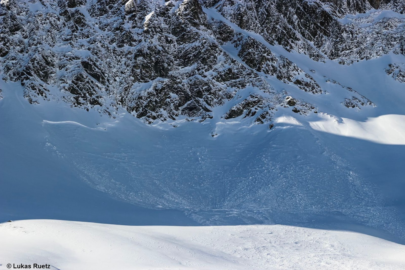
Naturally triggered avalanches were registered mostly on non-tracked, shady and leeward slopes, adjacent to ridgelines, in very steep terrain, as expected. Avalanches were mostly medium-sized (magnitude 2), in isolated cases also large-sized (magnitude 3).

Increasingly frequent reports of naturally triggered avalanches were received particularly in the Stubai Alps, also in the Verwall Massif. Few naturally triggered avalanches were registered in the Ötztal Alps. Similar conditions were registered in the freeriding terrain of the Arlberg and the regions of the Tux and Kitzbühel Alps where snow was shallow.

Naturally triggered slab avalanche in northern Stubai Alps. Classic danger zone: shady weak layer until now unaffected, expansively metamorphosed old snowpack surface. (photo: 30.01.2020)

Naturally triggered slab avalanche in Griesskogel Massif. Shady, steep terrain unaffected-by-wind. (photo: 30.01.2020)
Slab avalanche adjacent to ridgeline in Venegiger Massif (photo: 30.01.2020)

Ridgeline slab. Weisskugel. (photo: 30.01.2020)

Kappel ski area: left, a slab released naturally; right, released by explosives. (photo: 30.01.2020)

The artificial triggerings by explosives in the Kappl ski area were deemed successful. This was also the case in Kühtal and Seegrube above Innsbruck. Lesser successes were registered in the Arlberg region and the ski areas of the southern Ötztal Alps.

Successful artificial triggerings through explosives near Kühtal ski area. (photo: 30.01.2020)

Successful artificial triggerings on the Seegrube. The highly varied fracture surfaces are interesting. Probably graupel played a part (also in blanketed powder during the period of snowfall).

Avalanche releases in which persons were involved

On 28.01 two ice climbers in Innergschlöss were surprised by an avalanche in the so-called Schildfall when they were (after rapelling) in a 40-degrees gradient part of the wall. One person was swept along, but was able to reach the valley on his own.

Today, 30.01, two avalanche reports were received at headquarters. Each came from the Arlberg region. “In der Riffle” - one person was swept along, but was able to free himself and was then in treatment by mountain rescue, according to headquarters. In the avalanche at “Vorderen Rendl” no persons were buried in snow masses.

Ridgeline slabs are visible in photo. In foreground, two ski tracks leading out of the slab. Hochgurgl. (photo: 30.01.2020)

What’s next? Avalanche danger levels will increase...

In the next few days, weather will be turbulent and far too mild for the season. A warm front moving in tomorrow, Friday, 31.01.2020, will bring some rain up to 1800-2000 m. Only at high altitudes will there be some fresh snow, according to ZAMG Weather Service. Starting on Sunday, 02.02.2020, a persistent, stormy W/NW airstream will predominate which will bring very moist air masses to the northern flank of the Alps. The snowfall level will ascend accordingly.

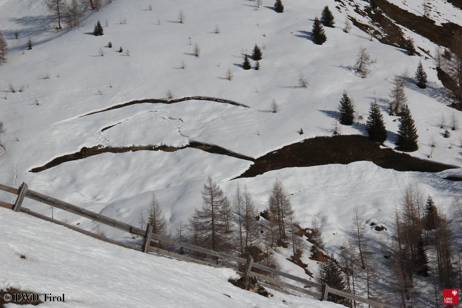
As a result of warmth and rain, glide-snow avalanches will increasingly become a problem. Dristköpfl. (photo: 29.01.2020)

Otherwise worthy of note.

The ZAMG Weather Service reports that January 2020 was one of the three warmest months in recorded history. Other attributes of the month of January: mild, dry, sunny.

Dust from the Sahara desert...

Dust and sand from the Sahara desert was observed in the air throughout the land during the week. Rastkogel, Tux Alps. (photo: 24.01.2020)

New snowdrift masses were generated in the heights today, 30.01.2020. Stubai Glacier. 

Strong winds set their stamp on the snowpack surface. Tux Alps. (photo; 30.01.2020)

Comparatively favourable situation in East Tirol, apart from Main Alpine Ridge. (photo: 30.01.2020)

Wintery weather with massive graupel showers on 28.01. Brief storm gusts up to 160 km/hr. Some ski areas had problems with that. (photo: 28.01.2020)

Graupel throughout the land. In some places the graupel layers were deeply embedded inside the layers of fresh fallen snow. In photo, Defereggental. (photo: 28.01.2020)

Tuesday 28 January 2020

Significant increase in avalanche danger due to snowfall + wind

After an extended period of beautiful weather, the big change has arrived. It will bring noticeable precipitation after a long dry spell. Fresh snow and winds will swiftly lead to a striking increase in avalanche danger. In the regions where snowfall is heaviest, avalanche level 4 (high) will be reached. Backcountry skiers and freeriders are particularly at risk. Exposed transportation routes will not be endangered, or only in isolated cases.

On the Vorarlberg border and in northern barrier cloud regions, 50-70 cm of fresh snow is expected by Wednesday, 29.1.20.

Weather
After a long period of fine weather, interrupted briefly by a weak perturbance on 18-19 January, a major weather change is coming, bringing notable amounts of precipitation. Today, 28.1, a cold front will pass through from the west, bringing fresh snow. The snowfall will be accompanied by strong to storm-strength and gusty northwesterly winds. Gusts of 80 km/hr are anticipated over widespread areas, in the Allgäu Alps-Karwendel region up to 100 km/hr. This cold front is the vanguard of a weather phase bringing variable, instable conditions, typical of a western airstream. It will remain highly variable even after the precipitation is over.

In the Allgäu Alps as far as the Karwendel, gusts of over 100 km/hr are expected.

Snowpack
The fresh snow will be deposited on top of an expansively metamorphosed snowpack which formed during the period of fine weather, including many nights of outgoing radiation. Once it is blanketed by bonded snow, this surface of faceted crystals will be an unfavourable snow base. On shady and wind-protected slopes, surface hoar has also been frequently observed. The loosely-packed old snowpack plus the fresh fallen snow are perfect ingredients for a highly accident-prone danger pattern, namely, dp.5 (snowfall after long period of cold.


An expansively metamorphosed snowpack all the way down to the ground is visible here in the Axamer Lizum, and is widespread throughout Tirol. .


Hard tracking in northern Stubai Alps because the snowpack is loose all the way down to the ground.

Loosely-packed, expansively metamorphosed snowpack surface in central East Tirol

On shady and wind-protected slopes, surface hoar is frequently observed.

The fresh snowdrifts can be easily triggered, even with minimal additional loading. Moreover, in regions where snowfall is heavy increasingly frequent naturally triggered avalanches can be expected. Avalanche danger will reach at least level 3 - considerable; and in the regions where snowfall is heavy, level 4 - high. The avalanche danger level refers mainly to winter sports enthusiasts, often nicknamed “Skier High” to connote that few very large avalanches can be expected but very many medium-to-large avalanches can trigger naturally. In addition, avalanches can be easily triggered even by minimum additional loading in many places. In such a “Skier High” phase, all backcountry skiers and freeriders are in acute danger. Exposed transportation routes are at risk only in isolated cases.

Skiing and freeriding tours in outlying terrain demand a lot of experience in danger assessment on-site, as well as a great deal of restraint (New snow problem).

Friday 24 January 2020

Main danger: fresh, easily recognizable drifts


Last week, high-pressure weather conditions were again prevalent, with short pauses (see previous blog). Winter sports enthusiasts usually enjoyed favourable conditions. Good powder could be found especially in regions where there was lots of fresh snow. Elsewhere, snow quality was modest-at-best except in wind-protected, shady zones.

Once again, superb backcountry touring conditions. On the way to Hochgasser (photo: 20.01.2020)
S
Brilliant sunshine in the Stubai Alps (photo: 22.01.2020)

Avalanche danger is moderate at high altitudes, at lower altitudes danger is low. Moderate danger is declared because of wind influence and freshly generated snowdrift accumulations. The snowdrift masses are often quite easy to trigger, however they are generally shallow and easy to recognize, especially by experienced backcountry tourers.

The main danger stems from freshly generated snowdrift masses, frequently on shady slopes. This applies particularly to zones which were wind-protected for longer periods. Naturally triggered slab. Glockturm Massif. (photo: 23.01.2020)

Weather

Currently, on 23.01, brilliant sunshine reigns throughout the land. Winds have intensified, however, and in some places are blowing above transport velocity.

Winds were strongest in the classic foehn lanes.

Snow transport near the ridgeline. A typical snapshot in many regions along the Main Alpine Ridge. (photo: 23.01.2020)

Snow transport was also registered in low lying areas, such as here in Boden, Ausserfern. (photo: 20.01.2020)


The ZAMG Weather Service wrote about this weather situation: “From the Atlantic over the British Isles and the Alps as far as the Balkans, a powerful high-pressure front is spreading very dry and, at high altitudes, mild air masses. In the valleys the cold air collects. On the weekend this high will weaken, slowly the conditions are expected to change to a westerly air current.”

Snowpack

What matters most for the snowpack are the weak near-surface layers. These are mostly loosely-packed, expansively metamorphosed (faceted) crystals which have been able to persist particularly in wind-protected (inc. shady) zones. But also on west and east-facing slopes there are thin melt-freeze crusts near the uppermost surface. These are only of importance if they get blanketed by fresh, somewhat thicker snowdrift accumulations.

Visible is the still loose, already faceted snowpack surface, on the one hand, and the thin snowdrift masses on the other. (photo: 23.01.2020)

 Near-surface profile: loosely-packed snow, beneath that a wind-impacted snowpack. The old snowpack is stable over widespread areas.

On sunny slopes, on the other hand, melt-freeze crusts predominate, with frozen water columns. Also there, the snowpack is stable by and large.


Frozen water columns are often found on steep south-facing slopes. (photo: 19.01.2020)

Disturbing the old snowpack is conceivable in isolated cases on extremely steep, shady slopes where the snow is shallow. And even there, there are encrusted layers of depth hoar frequently evident, in other words, layers which are not particularly weak.


A photo to match the snow profile above, although upside down. Visible is the hardened wind crust beneath the depth hoar (in the upper photo). The snow crystals of the depth hoar were encrusted in the spot where the profile was made. (photo: 23.01.2020)
A few other notes about the snowpack surface:

Frequently observed: a snowpack surface which is heavily wind-impacted. Central East Tirol. (photo: 17.01.2020) 

Becoming rare: powder snow (more frequent in regions with lots of fresh snow) and “burled powder”. Glockturm Massif. (photo: 23.01.2020)

In the Karwendel in the narrow altitude band 1900-2100 m, surface hoar formed where there was a swath of cloud previously. (photo: 22.01.2020) 

Avalanches

The details of the last blog are still applicable. In other words: caution urged especially towards freshly generated snowdrifts.

Fresh snowdrifts were easily triggerable in Aussefern. (photo: 19.01.2020)
In there regions where recent snowfall was heaviest, harmless loose-snow avalanches were observed.

Loose-snow avalanches in Hintertux. (photo: 20.01.2020)

Glide-snow avalanches are being registered only in very isolated cases. Generally, only the glide cracks in the snowpack are visible.

In principle, ready to trigger but seldom active. Glide-snow slides and avalanches. Samnaun. (photo: 22.01.2020)

Outlook

No significant change in avalanche danger levels is anticipated. Fresh, easily recognized masses of snowdrift should be avoided whenever possible in steep terrain.

Tuesday 21 January 2020

Caution: fresh snowdrift accumulations very easily triggered

In wind-impacted regions a serious snowdrift problem threatens winter sports enthusiasts. Freshly generated drifted masses are bonding (for a brief spell) extremely poorly with the frequently very loosely-packed (and cold) new fallen snow from 18-19 January 2020. (Inside the fresh snow there is also graupel that could form an additional weak layer, otherwise relatively insignificant).

Fresh, naturally triggered snowdrift mass. Tuxerjoch (photo: 21.01.2020)

The 3 ingredients of a snowdrift problem, i.e. for Danger Pattern 6 (loose snow and wind):

Fresh snow...

...which is loose and also cold... (visible in the photo: the glittering fresh-fallen snow crystals). Start of slight wind influence (photo: 20.01.2020)

Overview of the low temperatures following the snowfall

...along with wind impact. Current winds are southerly.

Snow plumes on Hintertux Glacier showcase the snow transport. (photo: 20.01.2020)

Weather developments of recent days at a wind-impacted station in Stubai Valley: fresh snow, temporarily low temperatures and wind impact beneath cloudless skies.

The good part about this is that with a certain amount of experience, the snowdrift masses can be easily recognized. In addition, the snowdrift problem is not a threat throughout the land, but only in regions along the Main Alpine Ridge and in the classic foehn lanes. In wind-protected places skiers and freeriders can still enjoy great powder.

On the other hand, fresh snowdrift masses should under all circumstances be circumvented in steep terrain.