Wednesday 30 December 2020

Several avalanches involving persons - no injuries - restraint still imperative

 Avalanche reports from Tirol headquarters

Since yesterday, 29 December, headquarters has received information about 8 avalanches involving persons:

29.12.2020: Juifenalm (northern Stubai Alps); Rosskopf (eastern Tux Alps); Angerbergkopf (northern Stubai Alps)

30.12.2020: Kleiner Leppleskofel (east. Defereggen mountains); Grosser Leppleskofel (east. Defereggen mountains); Rogötzllenke (east. Defereggen mountains); Muttenjoch (central Stubai Alps); Schönbergspitze (east. Defereggen mountains)

All these avalanches unleashed without injuries. According to latest information they were medium-sized slab avalanches, focal point in the Defereggen mountains


Violet dots: large area of avalanches in Defereggen mountains on 30 December


Continuing: serious avalanche situation, particularly in southern regions 

We have reduced the danger level for tomorrow (New Year’s Eve) from high to considerable, but in the southern regions we anticipate a delicate situation for skiers. Particularly where surface hoar is blanketed by snowdrifts, the drifted masses can be easily triggered by minimum additional loading. Today we received reports of settling noises, fracture cracks and remote triggerings, whereas naturally triggered avalanches were not observed. Quite fitting for these observations are two photos of an exemplary route selection and behavior adapted to the present situation.


Tour in flat to moderately-steep terrain near Golzentipp (Carnic Ridge) - (photo: 30.12.2020)


Arrow: a backcountry skier ends his tour at this point, before it gets steeper. Hoher Bösring - Carnic Ridge (photo: 30.12.2020)


Further north, caution urged towards fresh drifts, also towards trigger-sensitive old snow


On Monday night (28-29 December) there was far less in the northern regions, the amounts of snowfall gradually decreasing towards the north. Snowdrift accumulations are thus shallower than in the south. Nevertheless, the snowpack, at least above the timberline, is impacted by winds also there.


Wind sculpture generated by intensive wind force. Ötztal Alps (photo: 29.12.2020)


Hard slabs


Caution: precisely during storm-velocity cold phases, so-called hard slabs can be triggered increasingly frequently in steep terrain. The snowpack surface can sometimes be hard as steel. This has to do with the heightened brittleness of the slabs due to the low temperature. And of course a marked weak layer is an important element of such a hard slab. That can be found in transitions from shallow to deep snow and where the snow is shallow.
 

Snow lumps point to hardened slabs, Nauders mountains (photo: Hans Hofer, passed on by Florian Maas)


Outlook: first step into the new year

The ZAMG Weather Service has released new information for precipitation in the southern regions. For the first 3 days of the new year, about 30-50 cm of fresh snow can be expected in East Tirol, focal point will again be in the furthermost southern regions.

Thus, delicate avalanche conditions can again be expected for backcountry tourers. Winter sports enthusiasts need extremely good avalanche knowledge and restraint when they are in outlying terrain.


We wish one and all Happy New Year and many safe adventures in the wintery mountains. 
Yours, the Avalanche Service team of Tirol

Tuesday 29 December 2020

Regionally delicate situation for winter sports enthusiasts. In southern East Tirol, HIGH danger for backcountry skiers.

Avalanche releases, fractures, settling noises: clear signals of alarm. Fresh snowdrifts in steep terrain need to be circumvented.


Our prior assessment of a delicate situation regionally for winter sports enthusiasts was confirmed today, 29.12. We received repeated reports of mostly medium-sized, in isolated cases also large-sized naturally triggered avalanches. In addition, slab avalanches were triggered by persons. So far, no injuries.


Naturally triggered slab avalanche in Tux Alps (photo: 29.12.2020). On the windblown ridge, wind impact is amply evident.


This applies to southern parts of the land with more snowfall since yesterday (28.12), often 20-40 cm, from place to place as much as 60 cm of fresh snow, amid strong wind influence.


Precipitation 28-29 December. East Tirol got the brunt.


Snow, snow, snow - Lienz basin (photo: 29.12.2020)


Fresh snowdrifts react extremely sensitively to additional loading. They are deposited on top of the following weak layers:

  • Diamond snow (especially loosely-packed ‘champagne powder’) and loose powder in all aspects
  • Surface hoar, esp. at forest rims in all aspects, regionally also further up on north-facing slopes
  • Faceted crystals near melt-freeze crusts formed on 22 December (heightened trigger sensitivity on north-facing slopes at 2100-2300 m, in E-S-W aspects at 2200-2500 m.

Information received today about numerous fracture cracks and settling noises at forest rims and above.

We currently rank avalanche danger as HIGH (level 4), due to high proneness to snowpack triggering in southern East Tirol above timberline.


Danger level map for 30.12.2020


This is a so-called “Winter Sports Enthusiasts HIGH” - in other words, a situation in which likelihood of slab avalanches triggering above the timberline by additional loading on the snowpack is ranked as HIGH. In addition, avalanche prone locations are widespread, they occur in all aspects. This was the reason why our observer in southern East Tirol was able to carry out his explorations only in moderately steep terrain up to the treeline. Above that altitude, particularly due to limited visibility, it was too risky to tread the snowpack. On the borders of the “high danger” region, the risks above forest rims are also extremely high. Lots of experience is required, along with great restraint.

In conclusion, our repeated appeal to one and all: recently generated snowdrift accumulations in steep terrain should under all circumstances be CIRCUMVENTED.

Monday 28 December 2020

Fresh drifts often easily triggered. More frequent naturally triggered avalanches expected.

Cold, loose powder generating highly trigger-sensitive weak layer for fresh snowdrifts.

As a supplement to our last blog, a short notice to all winter sports enthusiasts: the Christmas holidays were marked by high quality powder. That is now over. In the interim, winds have increased in general, including distant from high peaks and distant from typical foehn lanes. Avalanche prone locations in the form of freshly generated snowdrift accumulations are on the increase. This applies particularly to the southern regions where heavy snowfall is getting underway.


Wind distribution in Tirol, 28.12. at 7:00 am, stormy southerly winds


Fresh snow forecast for next 48 hours: heaviest in furthermost south


Increasing cloud cover in southern regions; heavy wind impact in the mountains; Defereggental


Avalanche situation becoming treacherous for winter sports enthusiasts

Winter sports enthusiasts need to adjust to a really delicate situation brought about by winds and heavy precipitation in some regions. Fresh snowdrifts are often very poorly bonded with the cold, loose powder (which often is especially loose ‘diamond snow’). Settling noises and fracture cracks, also reports of the first naturally triggered avalanches, currently medium-sized, are clear-cut signs of danger.


Easily visible: intense wind influence including with fracture cracks, Gartalm-Hochleger, Tux Alps (photo: 27.12.2020)

Wind impact in the East Tirolean Tauern (photo: 27.12.2020)

Avalanche that triggered on the way to Hochgasser-East Tirolean Tauern. This was freshly drifted snow. (photo: 27.12.2020)

Our appeal to one and all: over the next few days, CIRCUMVENT all snowdrift accumulations in steep terrain.

Wednesday 23 December 2020

Fresh snow + wind heightening avalanche danger over the holidays

Intensifying snowdrift problem at higher altitudes

Since Monday (21.12), quite strong westerly winds have been blowing at high altitudes, generating new snow transport. The fresh snowdrift accumulations are currently (23.12) prone to triggering particularly above about 2400 m. This borderline will descend when a cold front strikes on 24-25 December.


Snow plumes at about 2900 m in the Ötztal Alps (photo: 22.12.2020)


The background:

Act I: during the period of fine weather and mild temperatures (Thursday 17.12 – Saturday 20.12) surface hoar formed during the clear nights. In addition, the snowpack surface became more loosely packed, especially at high altitudes and on shady slopes. Both those things together created a weak layer for all snowdrifts deposited on top of it.


Surface hoar in the Tux Alps (photo. 18.12.2020)

Act II: a warm front (Monday 21.12 – Tuesday 22.12) unleashed precipitation throughout Tirol (focal point: western regions). Wherever it rained, the loosely-packed surface and surface hoar became moist, thus destroying the potential weak layer. That’s the reason snowdrifts currently can be triggered only at higher altitudes, i.e. where both the loosely-packed surface and the surface hoar are still intact.


Snowpack simulation Axamer Lizum: the magenta line at the surface (19 - 22.12) shows a thin layer of surface hoar which was destroyed by rainfall on 22.12 (altitude: 2103 m, Axamer Lizum)


Distribution of precipitation 21-22 December. Most fell in the west, very little in the south.


Rainfall limits of warm front 21-22 December. Most at 2400 m; in East Tirol most at 2000 m.


The proneness to fresh snowdrifts triggering is evident from fracture cracks, on the one hand, and from small artificially triggered (in isolated cases naturally triggered) slab avalanches, on the other.


Fracture cracks when stepping on a fresh drift at 2900 m. The weak layer consisted of loose decomposed crystals and surface hoar. (southern Ötztal Alps, 22.12.2020)


Avalanche release, Mittagsköpfe, Sellraintal. Visible just below the rocks: a shallow fracture; below that, a group of people the avalanche struck. No injuries. 2900 m, SE (photo: 22.12.2020)


The advantage: with some experience in avalanche assessment on-site, the fresh snowdrifts are easily recognized. However, starting on 25 December they will be blanketed by fresh snow, making it harder to spot them.


Old-snow problem in NW regions of North Tirol


Last week the frequency of avalanche prone locations (where triggering is possible in old snow) decreased also in the regions where there is much less snow. Nevertheless, stability tests still show that weak ground-level layers fracture from the weight of skiers and slabs can be triggered. We know of two avalanches last week which involved persons (both on 19 December), which fractured in the expansively metamorphosed ground-level layers, one on Schlantekopf in the Glockturm Massif, one on Larsengrat in Muttekopf region near Imst. No injuries.


Snow profile in Tux Alps near Nafingalm. A ground-level loose layer is visible, potentially a weak layer for slab avalanches. (photo: 19.12.2020)


Avalanche Larsengrat; 2530 m, NE. Encircled: three persons who were struck. (photo: 19.12.2020)


Old snow problem will intensify due to fresh snow + wind

As a result of precipitation and strong winds forecast for 24-25 December (predicted initially as rainfall up to 2000 m by ZAMG Weather Service, subsequently as snowfall down to low lying areas) the old snow problem in the regions with little snow will intensify. This is due to the wide-ranging snowdrift masses. Avalanches can thus grow to larger size; moreover, fracture propagation is enhanced. North-facing slopes will be at increased risk, also east and west-facing slopes at higher altitudes.


Snow forecast for 72 hours (23.12 7:00 am – 26.12 7:00 am) most of it in furthermost western regions.


Unfavourable: clearly alternating soft and hard layers. Region in Lechtal Alps, Arlberg region


Outlook


Increasing avalanche danger

Avalanche danger levels will increase due to a cold front which will bring fresh snow and strong winds over the holidays. “Considerable” danger will be reached above the timberline.

Starting next week, a Mediterranean low will bring snowfall to the southern regions. Current forecasts are for 50 cm of fresh snow, more from place to place. This, more than anything else, will intensify the snowdrift problem.


The south, already with ample snow, will get a new round of fresh snow next week.


Potentially, danger pattern 4 (cold on warm)

For avalanche forecasters, the anticipated danger pattern 4 (cold on warm) is of interest. Currently, the snowpack surface is frequently moist up to about 2400 m (see rain map above). Starting on 25 December, cold snow will be deposited on top of this. Temperatures will remain low. Due to marked temperature gradients on the surface, loose faceted crystals can form inside the snowpack within a very short time, potentially a weak layer for slab avalanches. We will study this development very closely, together with our observers, and are grateful for any reports (send to lawine@tirol.gv.at).


The moistened snowpack surface from rain + mild temperatures generates lumps, about 2000 m in Obergurgl (photo: 22.12.2020)


The uppermost 5 cm of the snowpack is moist, with a temperature of 0°C (profile at 2040 m near Obergurgl on 22.12.2020).


The week in review


Generally favorable avalanche situation


In regions where snowfall was heaviest, favorable conditions reigned by and large. Those who love steep slopes had plenty to enjoy.


In the Venediger Massif in extremely steep terrain, on a thoroughly stable snowpack (photo: 19.12.2020)


Glide-snow activity greatly diminished


Glide-snow activity has receded enormously in the interim, although a certain risk still prevails.


Photo in Schmirntal. In foreground, ski tracks through the powder; in background, grassy slopes nearly bare of snow where numerous glide-snow avalanches have already released. (photo: 18.12.2020)


Glide-snow fracture in Sillian (photo: 20.12.2020)


Backcountry is full of skiers


We currently observe a veritable boom in backcountry ski touring. Until today, many also went skiing on the prepared ski slopes while the ski areas remained closed.


Full parking lot in Praxmar im Sellraintal, 20 December


Backcountry skiers on a prepared ski slope in Kühtai (photo: 17.12.2020)


Weather review


A mild week with temperatures rising another notch due to a warm front (21-22 December) that brought a bit of precipitation. Intensifying winds from varying directions. Galzig, Arlberg region

Friday 18 December 2020

Old-snow problem in western regions. Glide-snow problem where ample snow.

In North Tirol, a treacherous old-snow problem regionally, particularly on north-facing slopes above approximately 2200 m

Avalanches in the last few days involving people, together with our own snowpack analysis, confirm a quite treacherous old-snow problem in some regions. It is most pronounced in the northwestern regions of North Tirol where there has been little snow since the beginning of December. The threat in this regions is considerable above approximately 2200 m. Avalanche prone locations are found above 2200 m on north-facing slopes in particular, above about 3000 m also in other aspects. Threatened are zones where prior to the December snowfall there was already snow on the ground and where area-wide, loosely-packed weak layers formed.


Danger-level map for Friday, 18.12.2020. Considerable danger due to old-snow problem.


Avalanches of the last few days (old-snow problem)
 

On 12.12.2020 a slab was observed near Rietzer Grieskogel in Sellraintal on a very-steep NW slope at about 2500 m. Tracks were seen leading into the avalanche and out of it.


Slab avalanche Rietzer Grieskogel (photo: 12.12.2020)


On 14.12.2020 a slab avalanche triggered below the Kübelwände in the Muttekopf region near Imst while someone was descending the slope. The person was able to ski out of the avalanche. The terrain was very-steep at minimum, E-NE aspect, the fracture occurred at about 2600 m.

Slab on the Kübelwände. The avalanche triggered during the person’s descent where there was snow from early winter which was significantly faceted in places, orographically right, near the rock wall. (photo: 16.12.2020)


A snow profile near the Kübelwände fracture reveals the brighter mass of fresh snow (beginning of December) and the darker old snow mass. Just below the fresh snow is a loosely-packed, expansively metamorphosed layer: the relevant weak layer for the slab. (photo: 16.12.2020)
 

On 14.12 a backcountry skiier died on the Vorarlberg side of the Tirolean border region while descending from the Albonagrat above Stuben. Altitute 2300 m, northern aspect, at least very-steep.

On 15.12 two backcountry skiers triggered a slab avalanche below the Hintere Grieskogel during their descent from Pirchkogel. One person was swept along but was not injured. NE, 2700 m, very-steep to extremely-steep terrain.


At the center of the fracture, the two skiers’ entry tracks are visible. (photo: 17.12.2020)
 

Snow profile for the slab avalanche on Hinterer Grieskogel: location above the fracture near the ridgeline. The very soft layer consisting of loosely-packed depth hoar and faceted crystals formed the weak layer for the slab. It proved quite easy to initiate a fracture there, which then propagated.


On 17.12, headquarters was informed of an avalanche in the Mattun (Arlberg region). As yet we do not have further details. What is certain: no one came to grief.


Ongoing glide-snow problem in regions with heavy snow

Glide-snow activity has decreased in the interim, but gliding snow masses still can be expected on steep, smooth ground. For that reason, we ongoingly recommend avoiding zones below glide cracks in the snowpack surface. The moment when glide-snow avalanches release is – our frequent mantra – impossible to predict.


A risky place to stop: below glide-cracks. East Tirol. (photo: 10.12.2020)

Roads have repeatedly been buried by glide-snow avalanches, both in North Tirol and East Tirol wherever there is ample snow. Fortunately they have caused no damage. So far this season, damages from glide-snow avalanches have been limited. We know of a goods-cablecar for the Bonn-Matrei Refuge which was damaged.


Encircled: the goods cablecar. Visible: the fracture of the glide-snow avalanche. (photo: 11.12.2020)


Frequent glide-snow avalanches in some places in East Tirol (photo: 11.12.2020)


Snow gliding over the roof of a shed


 Rooftop avalanche at Muttekopf Refuge. Visible in background: the glide-snow fracture, a ‘wishbone’ crack and a gliding-snow slide (photo: 16.12.2020)


Impressive snow masses in Sillian (photo: 10.12.2020)


Also noteworthy:

The weather

Conditions were variable last week, with both northerly and southerly air currents. The rise in temperature starting on Monday, 14.12, was noteworthy.


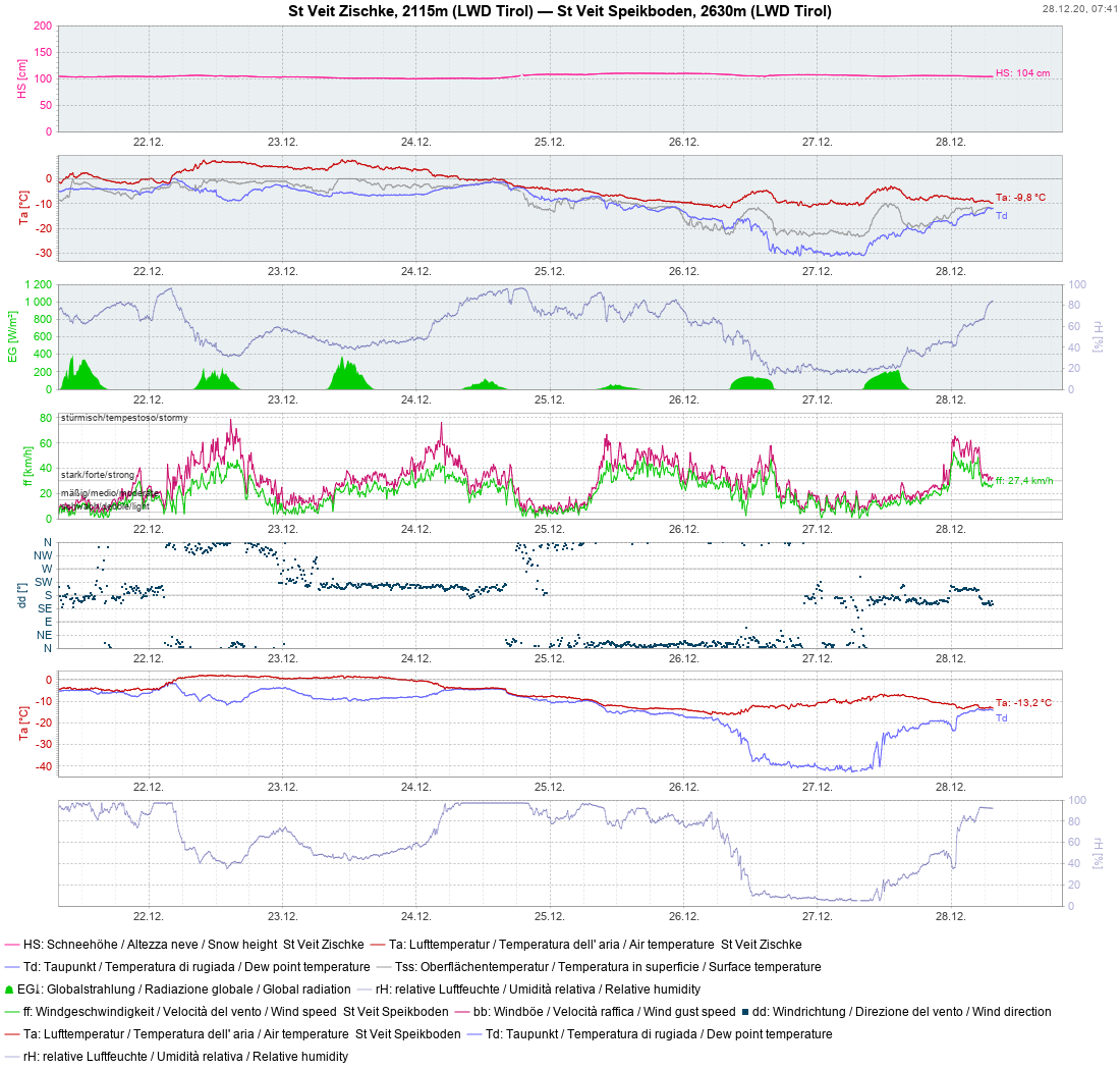
The snowpack settled further. Frequently strong winds from varying directions, particularly on Main Alpine Ridge at high altitudes. Clearly visible: the temperature rise starting on 14.12.2020.


Loosely-packed snow avalanches


Frequent loosely-packed snow avalanches on 15.12 as a result of rising temperatures. Mieming Massif (photo: 17.12.2020)


In the background: a loosely-packed snow avalanche in sunny, extremely-steep terrain.  Schlick    (photo: 16.12.2020) 


Overall snow depths


Snow distribution in Tirol: significant gradations from south to north. NW/NE regions have the least snow.


In regions with the most snow, the snowpack has settled and stabilized significantly. In some places there is still superb powder.


Apart from glide-snow avalanches referred to, positive aspects need to be emphasized. The snowpack has settled quite well, and stabilized. Winter sports enthusiasts are taking advantage of this situation and venturing frequently into extremely-steep terrain.


Extremely-steep descent in East Tirol (photo:

Following the termination of the heavy snowfall on 09.12.2020 there was initially very deep powder, then powder-to-perfection for deep-snow skiing. In the interim, higher temperatures have decimated the powder at low and intermediate altitudes, as well as in general on sunny slopes. Currently there is melt-freeze snow or a moistened snowpack surface. On shady slopes there is still powder at higher altitudes.


A dream come true: descent from Eselrücken in Virgental (photo: 12.12.2020)