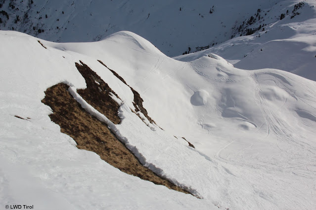
High avalanche danger due to new snow, rain, storm winds
 |
| Updated Avalanche Bulletin from this morning 29.12 shows it clearly: avalanche danger will increase significantly as of this evening, reach Danger Level 4 (“high”)! |
A warm front will reach us today (29.12) from the northwest, bringing lots of precipitation on the one hand, and stormy winds in the mountains on the other. Avalanche danger will thus climb rapidly. We expect numerous naturally triggered avalanches. The main activity will be during the nocturnal hours between today and tomorrow (29.12-30.12) which is when precipitation is heaviest. A comprehensive analysis of various avalanche scenarios comes at the end of this blog....
Short review of this week
Barrier cloud weather conditions brought us quite warm days during this last week. Precipitation was prevalent in the northern regions. The south was favoured. Avalanche danger tended to decrease to moderate, and low below the treeline.
 |
| Distribution of precipitation from 24-25 Dec - a similar picture to 26-27 Dec and 28-29 Dec. |
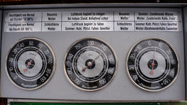 |
| Above-zero temperatures at Füssener Hütte (1550 m) on 25.12.2021 |
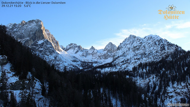 |
| The southern regions: favoured conditions. View from Dolomite refuge towards Lienz Dolomites (c) foto-webcam.eu |
The warm front and expected effects on avalanche danger levels
Rainfall at low and intermediate altitudes / Swiftly rising snowfall level to about 2500 m
When in the western regions precipitation set in during the afternoon on 29.12.2021, a warm front from the northwest announced itself. The ZAMG Weather Service forecast precipitation amounts of 25 to 50 mm, more from place to place. This applies to all of North Tirol and northern East Tirol. Most of the precipitation is expected in the western and northern regions of the land.
The fact is, precipitation at low and intermediate altitudes will be rainfall right from the start. At high altitudes it will be snowfall to begin with. However, the snowfall up to about 2500 m will rapidly turn to rainfall. The major intensity of this precipitation is anticipated for the nighttime hours of 29.12.
 |
| 24-hr forecast (29.12-30.12) of fresh snow expectation. Since this is a forecast of NEW SNOW, overall precipitation is NOT shown, due to the ascending rainfall level. |
Storm-strength winds in the mountains
Yesterday (28.12) winds intensified at high altitudes. Now we have to expect really stormy conditions in the mountains. Winds blowing mainly from the northwest.
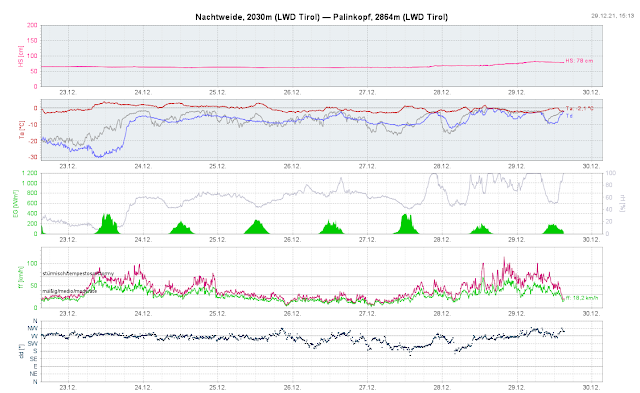 |
| Increasingly strong-to-stormy W/NW winds. Wind impact will generate far-reaching snowdrift accumulations in some places at high altitudes. |
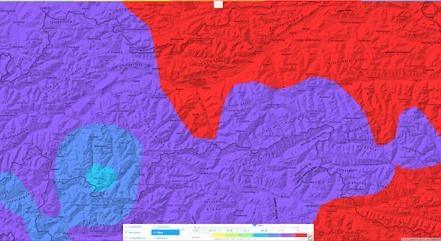 |
| Wind forecast for midnight 29.12.202 |
Naturally triggered avalanche activity
Based on the weather forecast, we assume there will be increased naturally triggered avalanche activity. That means several avalanche problems will overlap, potential avalanche scenarios will criss-cross.
In regions influenced by rainfall we have a wet-snow problem. Thus, we expect the following types of avalanches:
- wet loose-snow avalanches in extremely steep terrain in all aspects
- glide-snow slides and avalanches on steep grass-covered slopes in all aspects
- moist / wet slab avalanches particularly in west-facing, north-facing and east-facing terrain
Due to the rather shallow snowpack, loose-snow and glide-snow avalanches will predominantly be of medium size.
Moist slab avalanches, on the other hand, can also grow to large size, due to area-wide fracture propagation. There are two different types of moist slab avalanches which depend on the length of time the snowfall persists before turning to rain. Wherever there is more snowfall at the beginning, slab avalanches will fracture primarily in the zone of the current old snowpack surface, particularly beneath thin crusts atop a weak layer of faceted crystals. Wherever it snows only for a short time or not at all, the rain will swiftly penetrate the “warm” snowpack, depending on altitude and aspect. There we currently find a weak layer at mid-level inside the snowpack which formed in early winter. This was not triggerable in recent weeks. But penetrating, seeping water dissolves the bonding between crystals and reactivates this weak layer. This is then a wet-snow problem, just as we know it from early spring. In isolated cases the activation of this weak layer is only possible through the additional loading of the rain.
Naturally triggered slab avalanches in regions not influenced by rainfall
Another scenario exists with regard to naturally triggered slab avalanches in regions where there is persistent snowfall, or at least mostly snowfall. A weak layer for slab avalanches is seen in the old snowpack on 29.12. As mentioned, this is an expansively metamorphosed (faceted) weak layer which often is deposited beneath thin melt-freeze crusts or wind crusts.
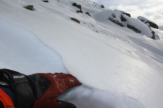 |
| A thin film of ice on the snowpack surface, and loose faceted crystals beneath that , i.e. the primary weak layer for the approaching layer of new snow. Tux Alps (photo: 28.12.2021) |
 |
| Snowfall, higher temperatures, wind impact together generate the “perfect slab” in an area-wide weak layer. Initial snow transport in the Tux Alps on 28.12.2021 |
Another scenario occurs in high alpine regions in glacial terrain. Through the additional loading of new snow and snowdrift accumulations, but also through primary surface-near naturally triggered avalanches, ground-level weak layers can be triggered. In isolated cases, large-sized avalanches are then possible. As a rule, these are zones which are far away from any and all infrastructure facilities.
"Mudslides with snow"
However in the framework of current weather forecasts it is also imaginable that we will have “mudslides with snow” in those areas where precipitation is heaviest and most rain-impacted. When the ground is saturated with water, the ground itself can start to move and subsequently take the snow along with it. Such an occurrence was experienced on 17.11.2019 in Stubai Valley.
Coming developments
Naturally triggered wet-snow avalanche activity is expected to diminish significantly when the precipitation eases tomorrow (30.12). Isolated dry-snow avalanches are then imaginable especially on very steep slopes at high altitudes where wind impact has deposited large amounts of snow.
What remains to deal with, for now, is well formed “slab” in the form of new snow and snowdrift, formed at high altitudes through the influence of the warm front. In our experience, that is when we ordinarily have especially good success with explosives, i.e. artificial triggerings. In some places we have to expect large slab avalanches which are triggered by winter sports enthusiasts, particularly at high altitudes.
As a result of higher temperatures over New Year’s Day (zero-degree level above 3000 m), Danger Level “high” will incrementally diminish at high altitudes.
We will make every effort to update this blog before the end of the year.


