Friday 25 February 2022

Main danger: weak layers in old snow

Still weak layers in old snow in places


Through snowpack analysis, stability tests and snowpack computer models we have been able to follow the development of the persistent weak layer since the beginning of the month. It has become clear that the danger zones are continually diminishing in frequency, but that under unfavorable circumstances avalanches can still trigger in the faceted layers, particularly at mid-level in the snowpack. In isolated cases, avalanches can even grow to large size, though most are now medium-sized.


Schneedeckenuntersuchungen helfen, das Altschneeproblem noch besser zu erfassen. Bielerhöhe (Foto: 20.02.2022)
Snowpack analysis helps to get a better grasp of the persistent weak layer. Bielerhöhe (photo: 20.02.2022)


Such avalanche prone locations occur most likely on W/N/E facing slopes between about 2200m and 2600m. However, there are also isolated such weak layers on south-facing slopes particularly above about 2600m. Avalanches can be triggered especially in transitions from shallow to deep snow. Ordinarily it needs large additional loading. The situation is usually known as “low probability – high consequence.”


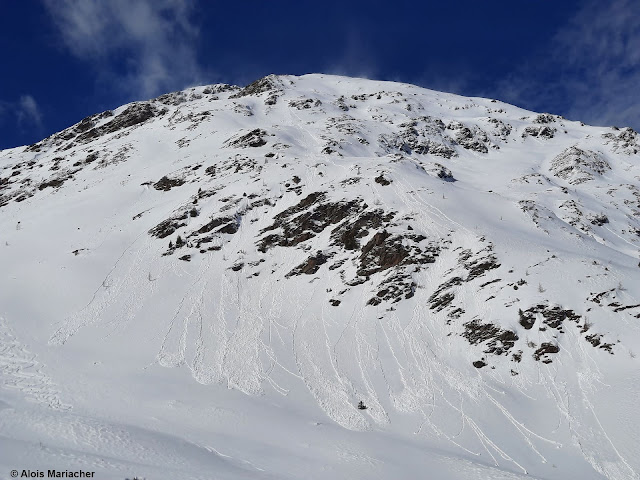
Spontaner Lawinenabgang vom 22.02.. Zunehmende Auflast aufgrund umfangreicher Schneeverfrachtungen. Nördliche Zillertaler Alpen, NO, 2400m (Foto: 23.02.2022)
Naturally triggered avalanche on 22.02. Increased additional loading due to wide-ranging snow transport. Hohe Warte, northern Zillertal Alps, NE, 2400m (photo: 23.02.2022)


Spontanes Schneebrett vom 22.02. aufgrund von Schneeverfrachtungen. Nördliche Stubaier Alpen (Foto: 24.02.2022)
Naturally triggered slab avalanche on 22.02 due to snow transport. Stiergschwetz, northern Stubai Alps, 2400m, N (photo: 24.02.2022)


Lawinenauslösung im Nahbereich des Taschachhauses am 20.02.2022 in der Weißkugelgruppe. NO, 2350m
Avalanche triggered near Taschachhaus on 20.02.2022, Weißkugel Massif, NE, 2350m 


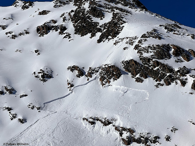
Ein durch einen Sprung ausgelöstes Schneebrett auf ca. 2600m Süd in den Ötztaler Alpen. Vermutlich reines Triebschneeproblem. Möglich: Kombiniertes Trieb- und Altschneeproblem. (Foto: 23.02.2022)
A slab that was triggered by a jump at about 2600m, S, Ötztal Alps. Presumably a snowdrift problem. Possibly snowdrift + persistent weak layer. (photo: 23.02.2022)

Today, 24.02, two avalanches were reported to Headquarters Tirol in which persons were injured. One was near the Marchginggeles in Innervillgraten (appx. 2500m, N), a further one in the Weißkugel Massif (appx. 2600m, S). 


A snowpack intensively sculpted by storm winds

Last week, once again the impact of storm-strength winds showed itself in the mountains. Winds were strongest on 22.02.2022. Fresh snowdrift accumulations were triggered particularly in steep terrain at high altitudes. Due to the already intensive solar radiation and the warmth inside the snowpack, most of the snowdrifts have bonded well with the old snowpack surface.


Eine der vergangene Woche neuschneereichsten Regionen: Das Arlberggebiet. Stürmischer Wind während des Schneefalls.
Where last week’s snowfall was heaviest: the Arlberg region. Storm-strength winds raged as the snow fell.


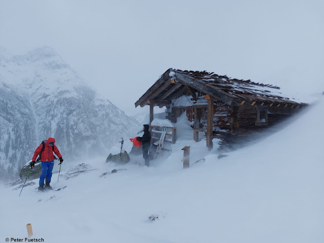
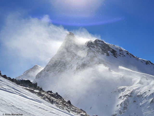
Sturmumtost: Venedigergruppe (Foto: 22.02.2022)
Storm-whipped: Venediger Massif (photo: 22.02.2022)


Zitat vom Fotografen: "Windkanal Tannheim" (Foto: 20.02.2022)
The photographer’s caption: “Wind Canal Tannheim” (photo: 20.02.2022)


Bezeichnend für ganz Tirol. Umfangreiche Schneeverfrachtungen. Grießkogelgruppe (Foto: 21.02.2022)
Illustrative for all of Tirol. Wide-ranging snow transport. Griesskogel Massif (photo: 21.02.2022)


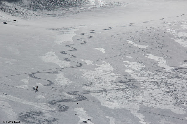
Ein häufiges Bild der Schneeoberfläche in Tirol: Stark vom Wind gezeichnet. Zudem für die Jahreszeit wenig Schnee. Deferegger Berge. (Foto: 24.02.2022)
A frequent image of Tirol’s snowpack surface: deeply etched by wind. In addition: not much snow for this juncture of the season. Deferegger mountains (photo: 24.02.2022)


Trotz unregelmäßiger Schneeoberfläche findet man mitunter recht guten Schnee zum Skifahren. Nördliche Stubaier Alpen (Foto: 24.02.2022)
Despite the irregular surface there is still good snow to ski on. Northern Stubai Alps (photo: 24.02.2022)


Below-average snow depths

Snow depths are far lower than usual in all the corners of Tirol, extraordinarily so in southern East Tirol.


Magenta: Schneehöhenverlauf des heurigen Winters. Kurzfristig erreichte die Gesamtschneehöhe das bisher gemessene Minimum (Messreihe seit 1961!)
Magenta line: development of snow depths this winter. For a short spell the overall snow depth touched the ultimate measured minimum (measurements since 1961!)


Blick vom südlichen Osttirol in Richtung Norden (Foto: 22.02.2022)
View from southern East Tirol to the north (photo: 22.02.2022)


In Sonnenhängen liegt gebietsweise besonders wenig Schnee. Nördliche Stubaier Alpen (Foto: 24.02.2022)
On sunny slopes there is often little snow. Northern Stubai Alps (photo: 24.02.2022)


Etwas Nachschub gabs zwischen dem 21.02. und 23.02.2022
A new round of fresh snow on 21.02. and 23.02.2022


Outlook

Initially, there will be little change in the current avalanche situation. The weather forecast is characterized thusly by the ZAMG Weather Service: “After a cold front passes through in the latter part of the night (24.02-25.02) temperatures will drop noticeably. Tomorrow (25.02) dry air masses will move through for a short time. On Saturday (26.02) a minor perturbance. Starting on Sunday (27.02) a high-pressure front will take over. Until the end of the weekend, average seasonal temperatures are expected.

Thursday 17 February 2022

Turbulent weather. Fresh snowdrift masses. Persistent weak layer continues. Moistened snowpack at low altitudes.

 Turbulent...


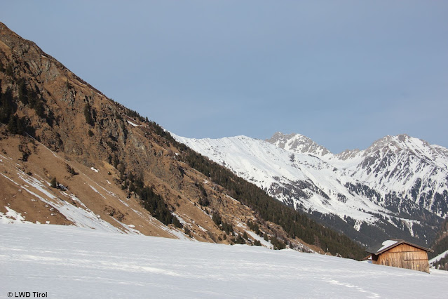
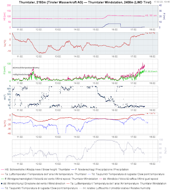
...that is doubtless the word which best describes current weather conditions. Precipitation (snow, followed by rain up to 2500m), gale-strength winds, fluctuating temperatures.


Neuschnee am 15.02.2022. Steigende Temperaturen. Stürmischer Wind im südlichen Osttirol

 Fresh snow on 15.02.2022. Rising temperatures. Storm-strength winds. (southern East Tirol)


24h Neuschneesumme 15.12. auf 16.12.2022 (bis zu 40cm waren es am Karnischen Kamm im Südlichen Osttirol
24-hr overall fresh snow 15-16 February (up to 40 cm on Carnic Ridge in southern East Tirol)


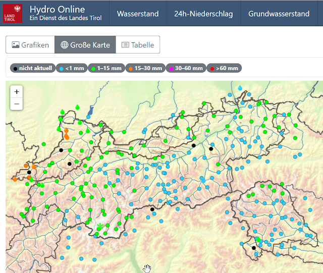
Im Westen des Landes gabs auch noch am 17.02. Niederschlag, bis in hohe Lagen als Regen.

Precipitation on 17 February also in western regions, as rain up to high altitudes.


Niederschlag mit Regen vom 16.02. auf den 17.02. Diesmal am meisten ganz im Westen des Landes
Precipitation with rain, 16.02 to 17.02. This time, mostly in westernmost regions.

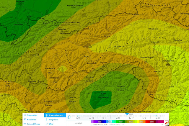
Ganz neu auf lawinen.report: Karte der (potentiellen) Schneefallgrenze. Hier jene vom 17.02.2022 06:00 Uhr
Quite new in lawinen.report: map of potential snowfall level. Here, from 17.02.2022 at 6:00 am


Effects on the snowpack and on avalanche danger

The minor snowfall of 15 February with little wind impact is currently being massively transported.  There are huge snow plumes visible in the mountains throughout the land. Fresh snowdrift accumulations are especially prone to triggering at high altitudes. Furthermore, in zones where snowfall was heaviest, such as southern East Tirol, also steep shady slopes can be struck by this up to intermediate altitudes.

Neuschnee vom 15.02. am Weg zur Vennspitze in den Nördlichen Zillertaler Alpen (Foto: 16.02.2022)
Fresh snow on 15 February on the way to Vennspitze, northern Zillertal Alps (photo: 16.02.2022)


Schneeverfrachtungen auf den Bergen. Hier im Defereggental (Foto: 17.02.2022)
Snow transport in the mountains. Defereggental (photo: 17.02.2022)


In addition, the snowpack surface at low and intermediate altitudes was moistened. In the furthermost western regions the intensive rainfall penetrated deep down into the snowpack. The combination of snowdrifts and higher temperatures led in isolated cases even to small-to-medium naturally triggered slab avalanches.

As a result of further rising temperatures on 18 February, the snowpack surface at low and intermediate altitudes will initially remain moist. Glide-snow avalanche activity could be heightened over the next few days, particularly in those regions where there was lots of rainfall.


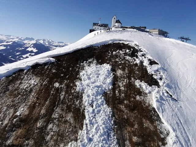
Gleitschneelawine, die sich am 14.02. unterhalb der Hohen Salve in den Westlichen Kitzbüheler Alpen löste. Ein Lawineneinsatz konnte abgebrochen werden.
Glide-snow avalanche, triggered on 14.02 beneath Hohe Salve, western Kitzbühel Alps. An avalanche operation was aborted in time.


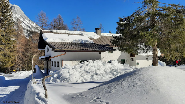
Erhöhte Wahrscheinlichkeit von Dachlawinen durch Regeneintrag und Wärmeeinfluss. M;ieminger Gebirge (Foto: 12.02.2022)
Heightened likelihood of rooftop avalanches due to rain and warmth. Mieming Massif (photo: 12.02.2022)


Feuchte bis nasse Lockerschneelawinen durch Regen- bzw. Wärmeeintrag. Defereggenberge (Foto: 17.02.2022)
Moist to wet loose-snow avalanches due to rainfall and warmth. Deferegger mountains
(photo: 17.02.2022)


As to the persistent weak layer discussed in recent blogs, there is no change. In some places, a slab is more pronounced due to warmth and additional snowdrifts, whereas the weak layer then becomes somewhat less prone to triggering. Fracture propagation over large distances is still possible.


Die Skispur deutet darauf hin, dass sich die Lawine löste, als die Person in deren Nahbereich war. Nördliche Stubaier Alpen (Foto: 14.02.2022)
Ski tracks indicate that the avalanche triggered when a person was very nearby. Northern Stubai Alps (photo: 14.02.2022)


Conditions remain instable. The avalanche situation remains unchanged.

In the wake of an unusually warm Friday (18.02) will follow a weak cold front on Saturday. It will remain windy, but not quite as stormy. A striking cold front is scheduled for Monday, 21.02.2022. East Tirol will get more favorable conditions.

Monday 14 February 2022

Avalanche accident analysis Schafseitenspitze, including thoughts about current persistent weak layer

 Avalanche accident Schafseitenspitze, 13.02.2022


Today, 14.02.2022, together with the Alpine Police we were below the Schafseitenspitz in the western Tux Alps in order to carry out orderly accident analysis.


Unterstützt wurden wir vom Landeshubschrauber (Foto: 14.02.2022)
Support from the State Helicopter (photo: 14.02.2022)


Course of accident

At the time of the accident there was one person on the summit of the Schafseitenspitze, a group of 6 persons on a ridge towards the summit and one sole backcountry tourer at some distance from the group of 6 in the steep  part of the slope. The group of 6 heard a whumpf noise on the ridge and noted a slab trigger nearby. The sole skier was swept along by the snow masses and utterly buried. He was quickly pinpointed by those who were untouched by the avalanche and unburied, but needed to be reanimated. The crew from the emergency medical helicopter continued reanimation efforts and flew him to the Innsbruck Clinic.


Überblicksbild der Unfalllawine. Der Pfeil zeigt die Aufstiegsrichtung der Skitourengeher. Während die 6-er Gruppe bereits am Rücken war, befand sich der Einzelgänger noch im Hang (im Nahbereich des Rückens). Die Ellipse zeigt die Verschüttungsstelle. Violett: Sekundärlawinen, die durch Bruchfortpflanzung innerhalb einer ausgeprägten Schwachschicht unmittelbar nach der Unfalllawine abgegangen sind. (Foto: 14.02.2022)
Overview of accident avalanche. Arrow points to ascent direction of the backcountry tourers. While the group of 6 was on the ridge, the lone skier was still in the slope (near the ridge). The ellipse indicates the point of burial. Shaded in violet: secondary avalanches which triggered by fracture propagation in the pronounced weak layer immediately after the primary avalanche. (photo: 14.02.2022)


Snowpack analysis

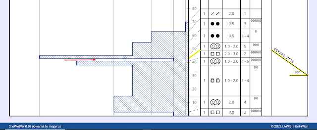
Our snowpack analysis resulted in the following picture: beneath fresh snow and snowdrifts from 31.01.2022 was a crust sandwich, i.e. two melt-freeze crusts between which was a loose-snow, faceted-crystal weak layer. This weak layer must have been constant and extensive over great distances, since only that way can the magnitude of the slab and the secondary avalanches be explained.

Schneeprofil im Bereich des flacheren Rückens, der Richtung Gipfel zieht. Der Pfeil zeigt auf die relevante Schwachschicht. Im Hintergrund ein Teil des Lawinenanrisses. (Foto: 14.02.2022)
Snow profile near the flat ridge extending toward the summit. Arrow shows the relevant weak layer. In background, part of the avalanche fracture. (photo: 14.02.2022)


Profil an oberem Standort: Der rote Pfeil zeigt die Schwachschicht, die an diesem Standort von einer dünnen Schmelzkruste sowie einer Eislamelle umgeben ist. Man benötigte mittlere Belastung um die Schwachschicht zu stören. Der Bruch pflanzte sich jeweils über den gesamten Block fort. Nord, 20°, 2420m.
Profile from above location: red arrow points to weak layer surrounded by a thin melt-freeze crust and a thin ice film. Medium loading was necessary to trigger the weak layer. The fracture propagated over the entire block. North, 20°, 2420m.


Blick von der Lawinenbahn in Richtung des Rückens. Man erkennt sehr gut die von rechts nach links deutlich abnehmende Anrissmächtigkeit des Schneebretts. (Foto: 14.02.2022)
View of plummet path towards the ridge. Visible: noticeably decreasing fracture depth of the slab from right to left. (photo: 14.02.2022)


Avalanche magnitude

This avalanche was a very large-sized slab avalanche, overall length 1050m, width 450m. The fracture depth lay mostly between 60 and 100cm with corresponding divergencies above and below. The avalanche triggered on a 40° steep north-facing slope. The buried person lay slightly more than a metre deep.
 
Verschüttungsstelle im Vordergrund samt Lawinenanriss ganz im Hintergrund. (Foto: 14.02.2022)
Spot of burial in foreground with avalanche fracture far in background. (photo: 14.02.2022)


Other thoughts about current persistent weak layer

In analyzing the numerous avalanche incidents, the following rough picture results. Most of the avalanches triggered at an altitude band between 2150 and 2600m in W/N/E aspects. Whereas 10 days ago the avalanches triggered mostly at lower altitudes, including below the treeline, the altitude band tended to ascend (currently at 2300-2600m).

In the Stubai Alps, by comparison, we observed increasingly frequent avalanches at altitudes between 2600m and just under 3000m on north-facing slopes. This is due to the comparatively small amounts of fresh fallen snow  which led to increased expansive metamorphosis in wind-protected shady terrain at the end of January.
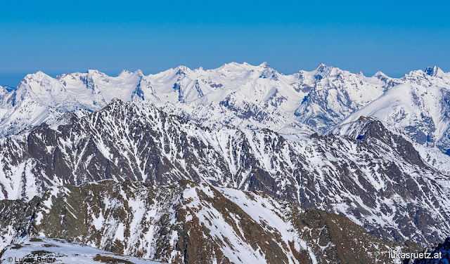

Blick von den Stubaier Alpen in die schneereicheren Nordalpen  (Foto: 13.02.2022)
View from Stubai Alps to the Northern Alps with much more snow (photo: 13.02.2022)


In addition, particularly in less frequented zones there are still whumpf noises and fractures in the surface. Avalanches are triggerable mostly in zones where the snow is shallow and in transitions from shallow to deep snow. They can still grow to large, sometimes to very large size....


Lawinenabgang Jochgrubenkopf am 11.02.2022. Es kam niemand zu Schaden (Foto: 14.02.2022)
Avalanche Jochgrubenkopf on 11.02.2022. No one was injured. (photo: 14.02.2022)


Spontane Lawinenabgänge Medrig (Variantengebiet des Skigebietes See im Paznauntal). Vergleiche Foto von diesem Blogeintrag) (Foto: 12.02.2022)
Naturally triggered avalanches on Medrig (freeriding terrain of See in Paznauntal Ski Area). Compare with photo from this Blog) (photo: 12.02.2022)


Lawinenabgang vom 13.02.2022 Hohe Warte im Wildlahnertal in den Nördlichen Zillertaler Alpen. Eine Person fuhr vom darüber liegenden Kamm in den Hang ein. Es passierte nichts. (Foto: 14.02.2022)
Avalanche from 13.02.2022 Hohe Warte in Wildlahnertal in northern Zillertal Alps. One person skied into the slope from the ridge above. Nothing happened. (photo: 14.02.2022)


Schneebrettabgang Seblasspitze in den Nördlichen Stubaier Alpen vom 13.02.2022. Es kam niemand zu Schaden (Foto: 14.02.2022)
Slab avalanache Seblasspitze, northern Stubai Alps, 13.02.2022. No injuries. (photo: 14.02.2022)

Also good things to report...

The avalanche situation in East Tirol is generally much more favorable. The persistent weak layer there is less pronounced. Caution is most necessary on north-facing slopes in very steep terrain in transitions from shallow to deep snow and in ridgeline terrain in all aspects at high altitudes.

It is also more favorable (as it has been all winter long) in terrain which is highly frequented by freeriders.

And on south-facing slopes, at least at intermediate altitude, you’ll find a quite stable snowpack with the pleasures of corn snow.


Firn bei der Abfahrt im Glocknergebiet (Foto: 14.02.2022)
Corn snow on the descent in Glockner region (photo: 14.02.2022)


It is getting turbulent again...

The weather is changing. Conditions are becoming highly variable: cold, warm, rain, storm. A little bit of everything. We will report again next Thursday, 17.02.2022 at latest.

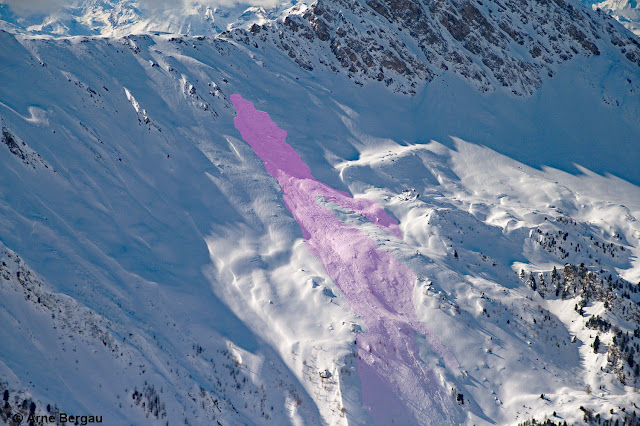
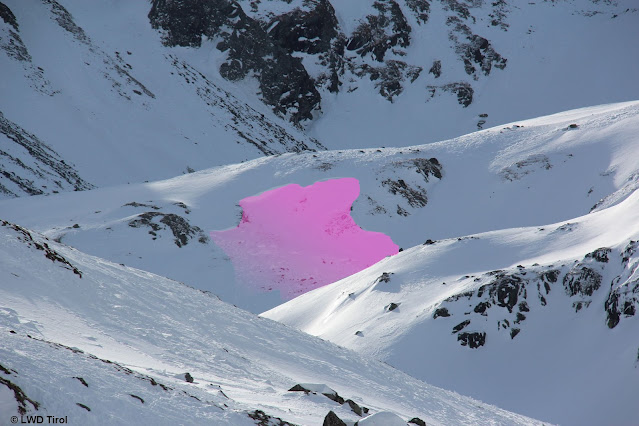
More recent avalanches involving persons. Very large avalanche on north-facing slope of Schafseitenspitze in western Tux Alps.

16 avalanches reported to Headquarters Tirol since Thursday, 10.02.2022

In two avalanche accidents persons were gravely injured. One was on Saturday, 12 February, in Kaunertal Glacier Ski Area freeriding terrain between Weißseejoch and Krummgampental, where a person in the descent was caught by a slab and remained atop the snowpack surface due to released avalanche-airbag.


Schneebrettabgang Richtung Krummgampental - Variantenbereich Kaunertaler Gletscher (Foto: 12.02.2022)
Slab released towards Krummgampental – freeriding terrain Kaunertal Glacier (photo: 12.02.2022)


Lawinenunfall Weißseejoch-Krummgampental Geländeneigung: Der Unfall passierte auf etwa 2600m in einem extrem steilen nordexponierten Hang
Avalanche accident Weißseejoch-Krummgampental terrain gradient: the accident occurred at about 2600m on an extremely steep north-facing slope.


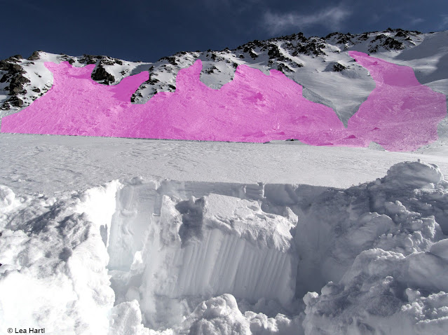
Today, 13 February, a very large slab avalanche triggered on the north face of the Schafseitenspitze in the western Tux Alps when persons were in their ascent. One person was swept away and totally buried in snow, but was able to be dug out by comrades and under reanimation was subsequently flown to the hospital.


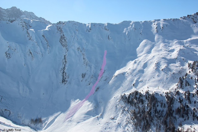
Sehr große Schneebrettlawine Schafseitenspitze (magenta). Durch den Lawinenabgang wurden zwei weitere Schneebrettlawinen fernausgelöst (violett). Foto: 13.02.2022
Very large slab avalanche Schafseitenspitze (magenta-shaded). This avalanche then remotely triggered two further slab avalanches (violet-shaded). photo: 13.02.2022


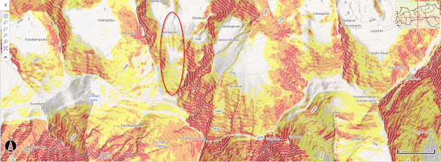
Geländeneigungskarte Schafseitenspitze mit Örtlichkeit des Lawinenabgangs.
Terrain gradient map Schafseitenspitze with avalanche release encircled.

Tomorrow, 14 February, we will investigate the avalanche accident on the Schafseitenspitze with the Alpine Police. Further details will follow in the next blog to be published soon.

Friday 11 February 2022

Persistent weak layer: treacherous!

Danger zones often unrecognizable


A persistent weak layer is characterized by a weak layer which ‘persists’ inside the snowpack, resulting in danger zones where avalanche prone locations are undetectable outside the snowpack. It is possible to localize such places only through systematic snowpack analysis and by perceiving the alarm signals (‘whumpf’ noises, triggered avalanches, fracture cracks, remote triggerings). These things make it possible to pinpoint the persistent weak layer rather precisely:

Persistent weak layer esp. between 1600m and 2500m on W/N/E-facing slopes

We currently assume that the persistent weak layer prevails mostly at an altitude between 1600m and 2500m on west-facing, north-facing and east-facing slopes. On south-facing slopes the avalanche prone locations occur only in isolated cases and at higher altitude.

In North Tirol the persistent weak layer is far more pronounced than in East Tirol

This assessment is corroborated by our observations from 23 January when freezing fog in North Tirol generated a quite striking crust on the snowpack surface. Subsequently, a pronounced layer of faceted crystals developed just beneath it. East Tirol had no such development, except in the northernmost regions.

Treacherous situation

The current avalanche situation is best described as ‘treacherous.’ Due to quite expansive and constant weak layers, large-sized avalanches are still possible. We can also still expect isolated remote triggerings from flat terrain. The more untouched the landscape is, the more likely is such a triggering.


Spontaner Lawinenabgang in der Östlichen Verwallgruppe (Foto: 08.02.2022)
Naturally triggered avalanche in eastern Verwall Massif (photo: 08.02.2022) 


Ein durch Fernauslösung abgegangenes Schneebrett im Arztal in den Tuxer Alpen (Foto: 05.02.2022)
A remotely triggered slab in Arztal, Tux Alps (photo: 05.02.2022)


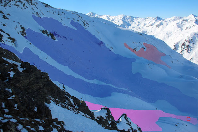
Lawinenabgänge Marchkopf in den Östlichen Tuxer Alpen: Am 08.02. löste ein Wintersportler primär das im Vordergrund ersichtliche Schneebrett aus und wurde beim Kreis total verschüttet. LVS-Gerät war nicht eingeschaltet dabei. Person konnte durch herausragenden Ski gerade noch rechtzeitig geborgen werden. Sekundär löste sich die blau eingefärbte Lawine. Das rot eingefärbte Schneebrett im Hintergrund wurde am selben Tag bereits etwas früher vermutlich auch von Wintersportlern ausgelöst. (Foto: 10.02.2022)
Avalanches on Marchkopf, eastern Tux Alps. On 8 February a winter sports enthusiast triggered primarily the slab visible in foreground and was totally buried at the encircled spot. An operating beacon was not nearby. Since a ski jutted out of the snow, the person was pinpointed and could be saved. A secondary avalanche triggered (marked in blue). The red-shaded slab in background was triggered earlier the same day, presumably by a skier. (photo: 10.02.2022)
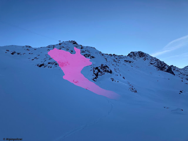

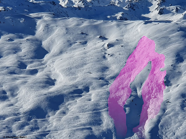
Lawinenabgänge Marchkopf: Ganz links: Lawine mit Einfahrtsspur. Ganz rechts als dünner Streifen dargestellt: Die am selben Tag früher vermutlich von Wintersportlern ausgelöste Schneebrettlawine. (Foto: 10.02.2022)
Avalanches on Marchkopf: at far left, avalanche with entry track. At far right, depicted as thin line: the other slab avalanche from the same day presumably triggered by a skier. (photo: 10.02.2022)


Schneebrett im Nahbereich des Gilfert in den Östlichen Tuxer Alpen (Foto: 06.02.2022)
Slab near Gilfert, eastern Tux Alps (photo: 06.02.2022)


Großflächiges Schneebrett auch in den Östlichen Lechtaler Alpen bei Namlos (Foto: 10.02.2022)
Expansive slab in eastern Lechtal Alps, near Namlos (photo: 10.02.2022)


Schneebretter. Links angrenzend ein viel befahrenes Variantengelände bei See im Paznauntal (Foto: 05.02.2022)
Slabs. At left, highly-frequented freeriding slope near See in Paznauntal (photo: 05.02.2022)


Sulztal im Nahbereich der Amberger Hütte: Das Schneebrett löste sich während der Abfahrt eines Wintersportlers. Kopf war außerhalb der Lawine. Personen konnten den Betroffenen unverletzt ausgraben. (Foto: 09.02.2022)
Sulztal near Amberger Refuge: slab triggered during descent of a winter sports enthusiast. Head protruded from the avalanche, persons were able to rescue him uninjured. (photo: 09.02.2022) 


Setzungsgeräusch samt Rissbildung in den Nördlichen Stubaier Alpen (Foto: 08.02.2022)
Settling noises and fracture cracks in northern Stubai Alps (photo: 08.02.2022)


Nearly always, the weak layers lie at mid-level inside the snowpack

Analysis of the avalanches results almost invariably in the same picture: the crucial weak layer lies near the surface of the old snowpack which got blanketed on 31 January. It consists of faceted crystals beneath a thin melt-freeze crust which in some cases is sandwiched in by an additional crust.

Beim Handschuh befindet sich die Schwachschicht, darüber eine dünne Kruste, darüber Trieb- und Neuschnee ab 31.01.2022. Ötztaler Alpen (Foto: 06.02.2022)
At the glove: the weak layer, above it a thin crust, atop of that fresh snow and snowdrifts from 31.01.2022. Ötztal Alps (photo: 06.02.2022) 


Schwachschicht unterhalb einer dünnen Schmelzkruste. Profil vom 05.02.2022; 2100m, 31°, West, Westliche Tuxer Alpen (c) Alexander Blümel
Weak layer beneath thin melt-freeze crust. Profile from 05.02.2022; 2100m, West 31°, western Tux Alps  (c) Alexander Blümel 


"Krusten-Sandwich" in den Westlichen Lechtaler Alpen. Profil vom 10.02.2022; 1970m, Nord, 30°, Östliche Lechtaler Alpen (c) Markus Fleischmann
‘Crust sandwich’ in eastern Lechtal Alps. Profile from 10.02.2022; 1970m, North, 30°,
(c) Markus Fleischmann 


Frequently observed: glide-snow avalanches

The last few days were quite warm, particularly at intermediate altitudes. The snowpack thereby became moist, where the snow was shallow often down to the ground. Glide-snow activities (avalanches and slides) were heightened correspondingly, at least at intermediate altitudes.


Gleitschneelawine, die am 10.02. abgegangen ist. Links davon erkennt man einen Gleitschneeriss. Östliche Tuxer Alpen
Glide-snow avalanche on 10.02. At left, a glide crack is visible. Eastern Tux Alps

Weather review

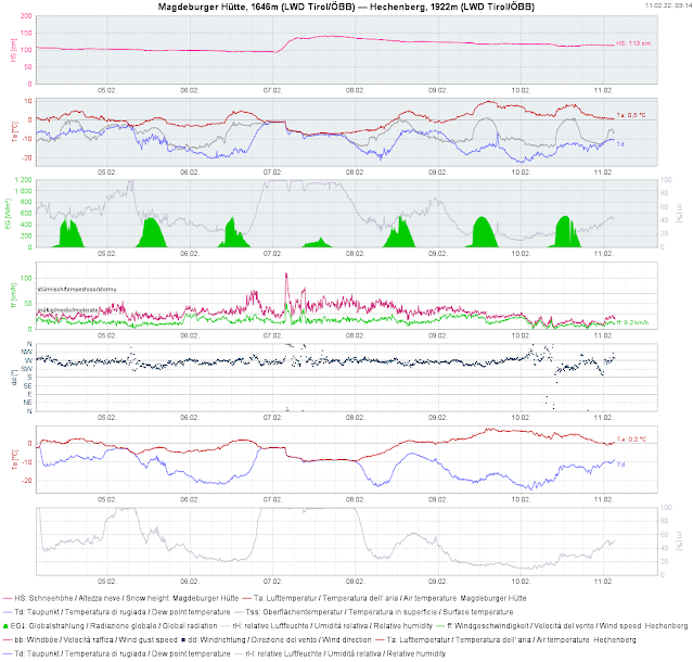
Last week bore the stamp of pretty intensive precipitation on 6 and 7 February, along with quite stormy conditions on 7 February. At Innsbruck Airport, the absolute maximum wind velocity was measured.


Historisch: Noch nie wurde am Innsbrucker Flughfen so eine hohe Windgeschwindigkeit gemessen (115 km/h)
Making history: never before were such windspeeds measured at Innsbruck Airport (115 km/h)


Der Sturm hinterließ auch im Gelände seine Spuren. Abgerissene Lärchenäste. Nördliches Osttirol (Foto: 08.02.2022)
Storm winds left a trail: broken branches of larch trees. Northern East Tirol
(photo: 08.02.2022)


Schlechtwetter mit Schneefall und Sturm am 06.02. und 07.02.. Anschließend wärmer werdend. Schneedecke wird im Tagesverlauf feucht
Ugly weather with snowfall and storm winds on 06.02 and 07.02. Subsequently, a warm weekend. Snowpack became moist during the day.


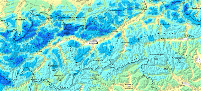
Differenz der Gesamtschneehöhe vom 06.02. auf den 07.02.
Difference in snow depths from 06.02 to 07.02.

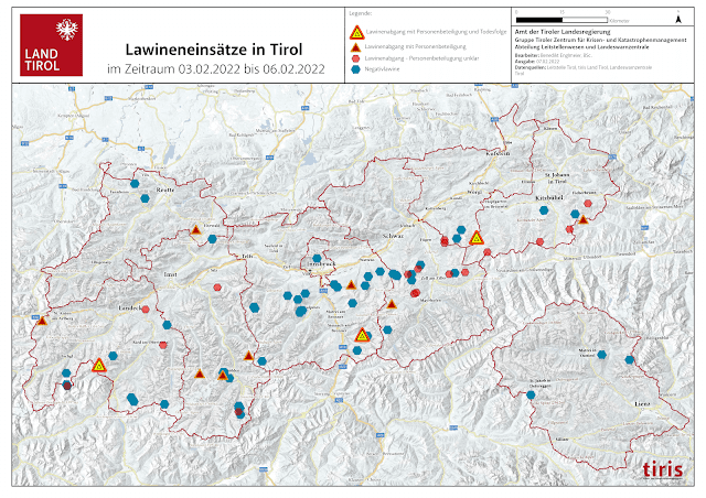
Extraordinary: the number of avalanches reported between 03.02. and 06.02.2022

Never before were so many avalanches reported to Headquarters Tirol in such a short period as last week. Here an overview:


71 Lawinen in 3 Tagen, davon 3 Lawinen mit insgesamt 8 Todesopfern. Die meisten Lawinen sind "Negativlawinen", also gemeldete Lawinen, bei denen definitiv keine Personen zu Schaden gekommen sind.
71 avalanches in 3 days, 3 with fatalities (8 dead). Most of the avalanches were so-called negative avalanches, i.e. reported releases in which no one was injured.


Outlook for the weekend

A cold front moving in on 11.02 will bring some fresh snow to Tirol. Generally about 10 cm is anticipated, somewhat more in the northwestern regions. Subsequently, skies should rapidly clear again. Saturday and Sunday promise to be beautiful-weather days with slight southerly-foehn influence. The persistent weak layer threat remains unchanged!


Wir appellieren an eine gute Tourenplanung und Zurückhaltung. (Foto: 09.02.2022)
We appeal to rational, intelligent backcountry tour planning and personal restraint. (photo: 09.02.2022)