In a nutshell...
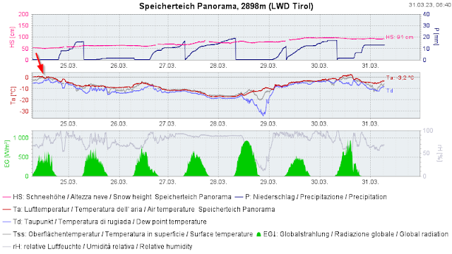
Rounding out the recent Blog, we want to draw your attention to the potential development of a weak layer due to cold on warm (dp.4). All signs currently point to a layer at very high altitudes on sunny slopes (bordering on a layer which last week was the moist-to-wet snowpack surface, then got blanketed by fresh snow) having become a weak layer. That weak layer could cause accidents during the coming days!
Cold on warm (dp.4)
There are currently only a few instances which corroborate this assumption. Nevertheless, they are sufficient to focus our attention on the process by which potential weak layers are formed and inform our readers about that development.
Where do we foresee dp.4?
Cold on warm can be significant wherever the wet snowpack surface was blanketed by thick snow masses (the “slab”) last Friday (24.03.2023). This includes the North Tirol and northern East Tirol regions which recently had major snowfall (see recent Blog). At the moment that means at very high altitudes, at least above 2500m, but applies also to very steep sunny slopes in high alpine regions (above 3000m).
A complex situation regionally
The situation is complex because an expansively metamorphosed weak layer currently developing in some places covers another weak layer which is located somewhat below it. That other weak layer (it lies beneath a thin melt-freeze crust) takes the form of faceted crystals and was generated during the long period with almost no precipitation between the beginning of February and the beginning of March. It occurred increasingly on steep NE/E/SE-facing slopes at about 2500m and upwards
 |
| The faceted layer depicted in upper graph formed during the specified period of very little precipitation. |
Be aware of heightened risk at altitudes and aspects we referred to.
We are grateful for all reports from backcountry terrain!
Due to a lack of reports and a dearth of comprehensive snowpack analysis, we are currently highly grateful for all clear professional reports! A quick glance inside the snowpack including a rapid stability test gives us valuable information which we will pass on to all winter sports enthusiasts, lawine@tirol.gv.at


