In a nutshell...
Today (Thursday, 30.03.2023) the recently fallen snow was moistened up to high altitudes by the warm April weather. Thereby, a pronounced “slab” was formed. An avalanche is likely to trigger wherever there are weak layers inside the snowpack. Most of the slab-avalanche prone locations currently occur on very steep NE/E facing slopes above 2600m; more often on SE-facing slopes in high alpine regions (above 3000m). General caution is also urged in very steep terrain in all aspects at very high altitudes behind abrupt drops in the terrain: that is where fresh snowdrift accumulations are easy to trigger.
April weather
Today, 30.03, there was rainfall up to 2300m in North Tirol and northern East Tirol. Thunderstorms were also registered. And the sun returned repeatedly. You guessed it: a genuine April day, when the snowpack was hit by lots of warmth. The recently fallen snow was moistened at least superficially up to very high altitudes.
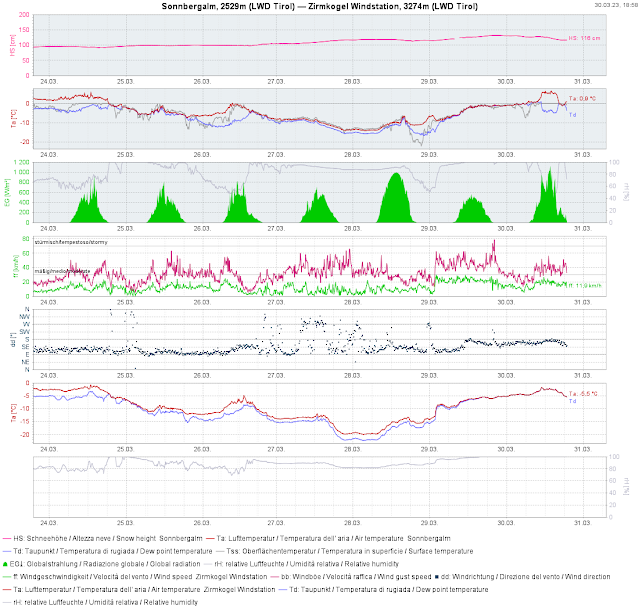 |
| During last week, only tiny windows of good weather. Today, 30.03, very warm again. Snowpack superficially moist up to very high altitudes. Now the temperature is dropping again. |
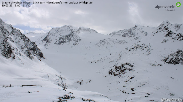 |
| A day with lots of diffuse radiation furthers warmth inside the snowpack. |
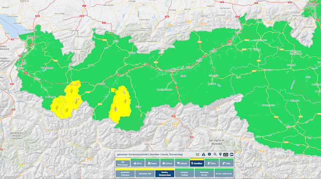 |
| Geosphere Austria warned of thunderstorms today, 30.03. They arrived as forecast, often containing graupel at very high altitudes. |
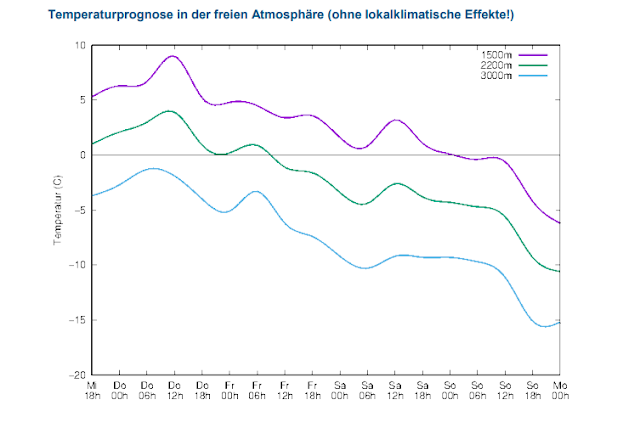 |
| The pinnacle of air temperatures has been reached for the moment. Now temperatures are going to drop steadily. The wet-snow problem will recede. |
Recent avalanches
Today, 30.03, several avalanches were reported. In some places the fresh fallen snow triggered in the form of numerous wet loose-snow avalanches. Sometimes they were only small slides. In ridgeline terrain at very high altitudes, slab avalanches were reported.
.jpg) |
| The slab avalanche on Hinteren Wilden Turm in the Alpeiner moungains triggered at over 3000m, possibly through the impuls of a cornice breaking, perhaps even naturally. (photo 30.03.2023) |
_bearbeitet.jpg) |
| Ridgeline slab avalanche near the Ruderhofspitze in central Stubai Alps (photo: 30.03.2023) |
.jpg) |
| Numerous loose-snow avalanches in Gurgler Massif (photo: 30.03.2023) |
.jpg) |
| Knobs forming in the Weisskugel Massif (photo: 30.03.2023) |
And again: poor snow quality
In many places the snowpack surface forms a breakable crust due to dropping temperatures. As we all know, melt-freeze crusts reduce the pleasures of skiing. (Two days ago, on 28.03, winter sports enthusiasts who took advantage of the right moment and headed into backcountry very early in the day were rewarded with fantastic powder.) That, too, is part and parcel of springtime: tiny changes effect swift changes in snow quality, as well as in avalanche danger.
What’s on the horizon?
The wet snow problem will recede with each passing day that the temperatures descend. Nevertheless, diffuse radiation will still have a short impact on the wetness of the snowpack, weakening it. Remember that near-surface avalanches can sweep away deeply embedded wet layers particularly at intermediate altitudes. Outside of that, not much change is expected. Be aware that in the regions where recent snowfall was heaviest at high altitudes there is currently higher risk on NE/E/SE-facing slopes. Be on the lookout for freshly generated snowdrift accumulations. And don’t forget to heed the shallow covering of glacier crevices for this juncture of the season. We are entering the phase of highly variable April weather.
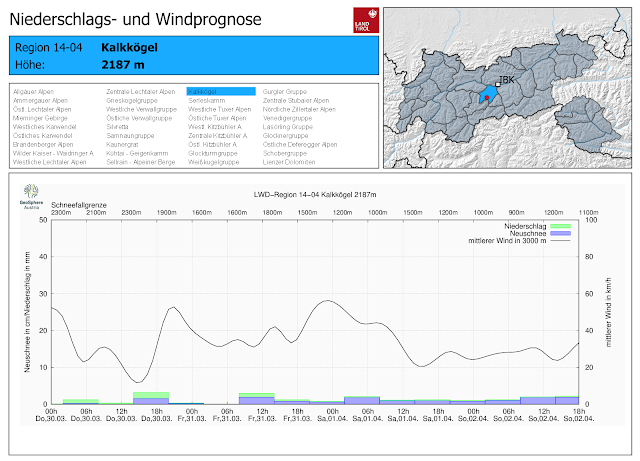 |
| Repeated bouts of precipitation, rather windy amid falling temperatures |