In a nutshell...
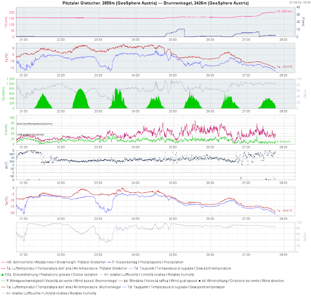
Lots of fresh snow regionally, strong-to-storm strength winds, low temperatures and anticipated solar radiation are all adding up to an accident-prone avalanche situation. Winter sports enthusiasts can easily trigger slab avalanches in steep terrain in the areas of major precipitation. Tomorrow (28.03 which is expected will weaken the snowpack further, despite low temperatures. We expect increasingly frequent naturally triggered avalanches particularly on sunny slopes, slab avalanches are possible, loose-snow avalanches are expected, glide-snow avalanches are possible on steep grass-covered slopes. You have to be aware that in the areas of great snowfall in open terrain, there is heightened risk.
Since Friday 24.03 there has been heavy snowfall from place to place. Storm-strength winds transported the snow.
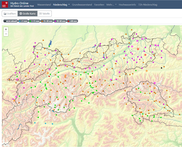
Between Friday 24.03 and Saturday 25.03 as well as on Sunday 26.03 to Monday 27.03 there was snowfall registered in far-reaching parts of Tirol. Whereas in the first bout there was mostly 10-20 cm registered, in northern East Tirol as much as 40 cm, the second round of precipitation brought to the western and northern regions, and also along the Main Alpine Ridge at high altitudes in particular, as much as 40-60 cm of fresh snow. The snowfall was accompanied by storm-strength winds. In addition temperatures dropped noticeably.
 |
| 72-hr precipitation in Tirol: focus 27.03, 6 o’clock pm |
 |
| Tomorrow (28.03) an interlude in precipitation is expected. Winds will taper off. The sun will come out. |
Trigger-sensitive snowpack
.jpg) |
| Graupel was able to form repeatedly during the most recent periods of precipitation. Wherever this was deposited, a weak layer can form. |
The fresh fallen snow lies deposited atop a more or less pronounced melt-freeze crust which formed after the drop in temperatures on Saturday, 25.03. Beneath that there is a wet, at very least moist old snowpack on sunny slopes up to at least 2800 m. On shady slopes this is the case up to about 2400m. The wet old snowpack formed a weak layer for the slab in the course of several avalanche releases, consisting of melt-freeze crust and fresh fallen snow. (In the interim, this weak layer is no longer likely to trigger.) BUT: in the case of avalanche releases in the fresh snow, the moist-to-wet old snowpack can also be swept away due to the additional loading of the triggered snow. Avalanches can thereby grow to larger size.
Danger Level “Cold-on-warm”
At the present moment we are faced with the prerequisites of Danger Level “cold on warm”: a wet old snowpack has been blanketed by cold snow. As to how much the already generated thin melt-freeze crust will generate faceted crystals as a later weak layer, is still an unanswered question. We concentrate on this process and are, naturally, grateful for any and all reports (at best via mail to lawine@tirol.gv.at).
