The most important message, right off the bat:
In the regions where snowfall has been heaviest, you need profound knowledge of the terrain and of avalanche science, you also have to be calm and restrained when you are in backcountry. Danger zones are widespread, often difficult to recognize, making accidents quite likely. By the way, we are very close to Danger Level 4 (HIGH danger) in the areas where snowfall has been heaviest.
Warm front raises proneness to triggering
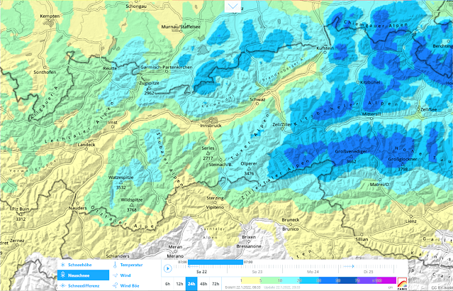
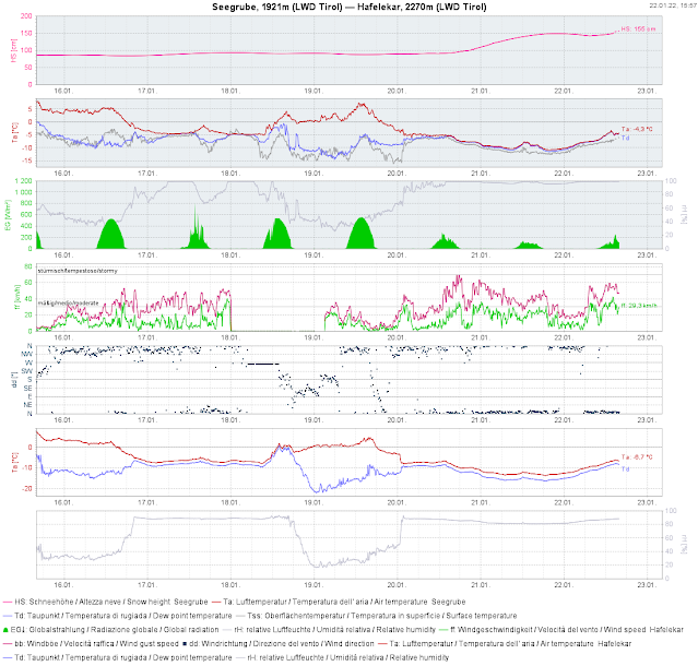
Today, 22.01.2022, the warm front forecast by ZAMG Weather Service moved into the eastern regions, bringing 20-50 cm of fresh snow (by tomorrow morning). Thus, within 48 hours there has been up to 100 cm of fresh snow registered locally, accompanied by strong and gusty northerly winds. Since the perturbance has the character of a warm front, we have to assume that initially cold new snow will be covered over by warmer, wind-impacted snow. The colder new snow can constitute a widespread trigger-sensitve weak layer for the bonded new snow which is deposited on top of it. In addition, there is greater potential of slab avalanches due to the expansively metamorphosed surface on shady slopes which were previously protected from wind (referred to in the last blog).
 |
| 24-hr fresh snow forecast for 23 January 2022. Latest forecasts predict even more new snow. |
 |
| Windy, past and still ongoing. En route to the Grubenkopf - central Stubai Alps. (photo: 21.01.2022) |
Naturally triggered avalanches
In regular increments, naturally triggered avalanches can be expected. These will be slab, glide-snow and loose-snow avalanches.
Slab avalanches
Particularly in the regions where fresh snowfall has been heaviest, naturally triggered avalanches can be increasingly expected during the evening and nighttime hours. These will be mostly medium-sized, in isolated cases large-sized. Since clouds will disperse tomorrow in the regions where snowfall was heaviest, there is no longer an impulse for further naturally triggered avalanches from solar radiation.
Glide-snow avalanches
At low and intermediate altitudes the fresh fallen snow was frequently deposited on bare ground, at least on sunny slopes. During the coming days, once again in the regions where snowfall has been heaviest, increasingly frequent glide-snow slides and generally medium-sized glide-snow avalanches can be expected there. The beautiful weather which is forecast with slowly rising temperatures will slightly raise the likelihood of such avalanches triggering.
Loose-snow avalanches
Tomorrow, Sunday 23.01, wherever it has snowed in the last few days and sunshine has been strong, naturally triggered loose-snow avalanches can be expected. Elsewhere this will be the case on Monday, 24.01 at latest. This means loose-snow avalanches in extremely steep, mostly rocky terrain on south-facing slopes.
Today (22.01): first avalanches involving persons
Tirol Headquarters reported today two “negative avalanches” - in other words, releases which involved persons, although they were not injured. This occurred in the Sonntagköpfl zone in the eastern Tux Alps and in the zone of Mitterkars in the town of Brandberg in the northern Zillertal Alps.
Accident-prone days – we urge you to calm restraint in your undertakings!
Following a stormy period of snowfall where improving weather conditions usually bring more frequent avalanches involving persons, we would like to point out the above avalanches as a warning.
