Some fresh snow and storm winds are ratcheting up avalanche danger
After several days of mostly favorable avalanche conditions and low danger levels, the danger will increase somewhat over the next few days.
 |
| Danger Level map for today 27.01.2022. In far-ranging areas of the Alps, low danger predominates. Starting tomorrow, 28.01, danger will rise slowly, but continually. |
Main danger: fresh snowdrifts increasingly numerous on shady slopes and ridgelines
By the weekend, snowfall and storm-strength winds from the northwest will generate new snowdrift accumulations. They will occur mostly in the NE regions where snowfall is heaviest, where between 5 and 15 cm of fresh snow is anticipated tomorrow.
 |
| 48-hr new snow forecast until Saturday, 29.01.2022 early morning |
 |
| At Nachtweide station in Silvretta Skiarena, strong-to-storm strength high-altitude winds already visible. |
Particularly on steep shady slopes we expect heightened proneness to triggering in these freshly generated snowdrift masses. This is mostly due to the structure of the uppermost layer of the snowpack: it consists predominantly of loose, expansively metamorphosed (faceted) snow, in some places of (encrusted) surface hoar. (For details, see below...) Heightened caution is also urged in ridgeline terrain and behind protruberances in the other aspects. Poor visibility can make evaluating the risks on-site more difficult.
Review of last week
After the last Blog, when we warned about accident-prone days there actually were increasingly numerous reports of avalanches involving persons. These were mostly small-to-medium slab releases, logically enough more in the eastern regions where snowfall was heaviest. There were no injuries. What was also pleasing was that the avalanches were so frequently reported to the Avalanche Headquarters in Tirol so that no unnecessary rescue operations were sent out.
Some avalanches involving persons
For details about all the known avalanches, click here:
 |
| Small slab in the Tux Alps (photo: 23.01.2022) |
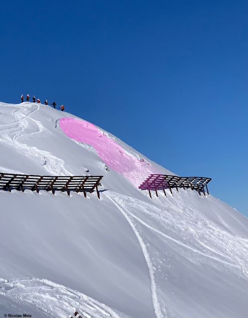 |
| Slab release Hüttenkogel in Zillertal. In a similar incident, persons near the deposit zone of the steel snow bridge were buried, but escaped unhurt. (photo: 23.01.2022) |
In eastern regions, lots of fresh snow, then beautiful weather took over, avalanche danger quickly receded.
Hot spots during last week’s snowfall (21-23.01): parts of the Karwendel; Wilder Kaiser / Waidring Alps region; eastern Kitzbühel Alps.
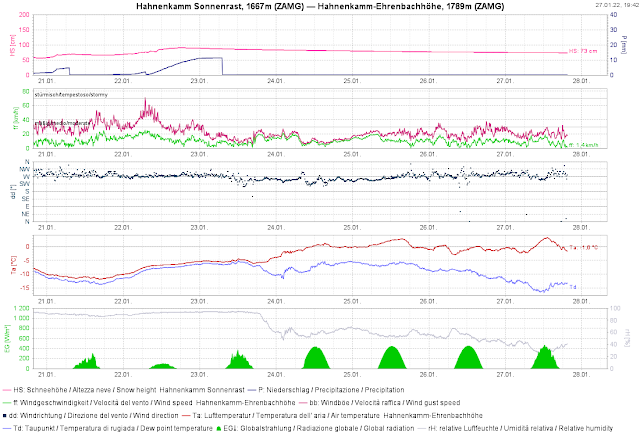 |
Fresh snow and wind to start with, then increasingly beautiful weather, warm temperatures, often windy.
 |
| Unmistakeable in foreground and in background: wind impact. East Tirolean Tauern (photo: 23.01.2022) |
Fog reinforced (encrusted) surface hoar
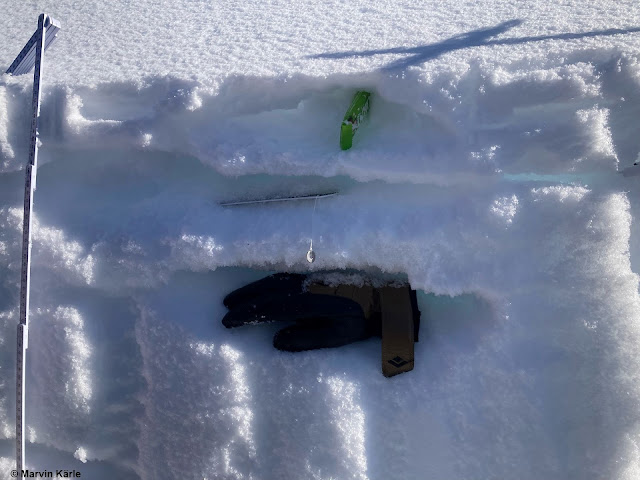
An interesting phenomenon was observed towards the end of the round of precipitation starting Saturday, 22.01 in the evening: near fogbanks and receding swathes of fog, surface hoar formed over widespread areas. Intensely cooled waterdrops also froze on the snowpack surface so that subsequently the surface hoar became encrusted, in some places ice sheets even formed. The fine weather which followed, including perfect solar radiation, then reinforced the expansive metamorphosis beneath these crusts. This is an important factor in the approaching snowfall, since there will be poor bonding to the new snow/drifts.
 |
| Fogbanks in Ausserfern (photo: 23.01.2022) |
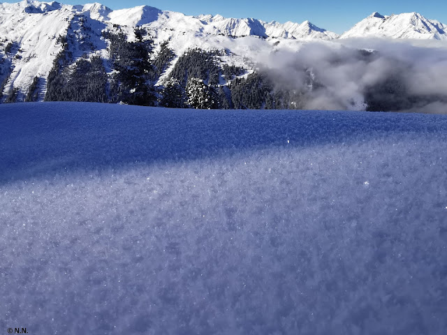 |
| In background, receding fog. In foreground, the surface hoar it created. Northern Stubai Alps (photo: 23.01.2022) |
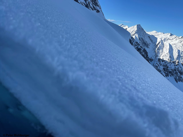 |
| Surface hoar near Ahornspitze, Zillertal Alps (photo: 26.01.2022) |
Thanks to our numerous observers, their explorations of the terrain and reports made by winter sports enthusiasts, we have an excellent overview of how far-reaching this phenomenon really is. Typical is the band of altitude inside which (encrusted) surface hoar was so prevalent. The crusts varied greatly, were thicker in the north than in the south of North Tirol. It was almost exclusively hoar only on the surface.
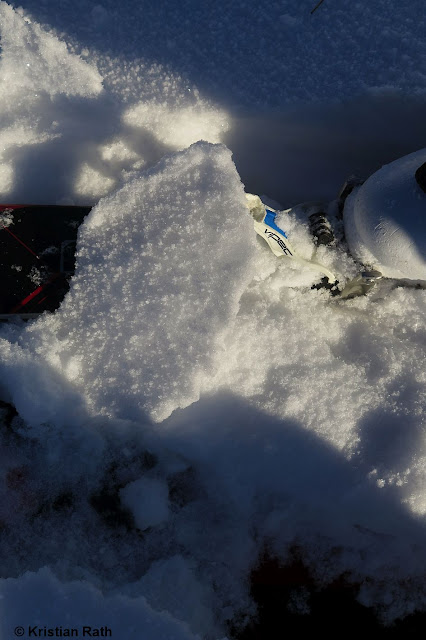 |
| Encrusted surface hoar in Tannheimertal (photo: 23.01.2022) |
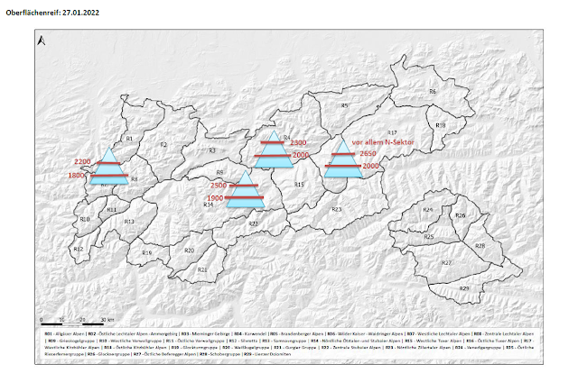 |
| Rough spread of (encrusted) surface hoar: all in northern aspects. |
Below-average snow depths
Nothing has changed yet in the starkly below-average snow depths for this juncture of the season.
 |
| Current overall snow depths (magenta) at Steeg station in Ausserfern. The dark line shows the long-term medium values. In addition, maxima and minima are also depicted. |
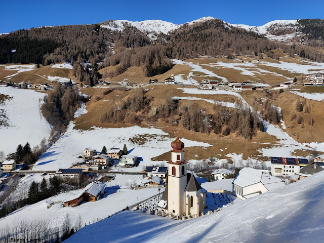 |
| In Navistal: on sunny slopes, the bare ground looks like spring. (photo: 26.01.2022) |
 |
| View from Ötztal exit to the north. (photo: 25.01.2022) |
Outlook
The variable weather conditions which are being launched are expected to become more turbulent as of Sunday, 30.01: storm-strength winds, then a sequence of cold and warm fronts, will mark a re-entry of real winter, including measurably higher avalanche danger. The focus of precipitation: western and northwestern regions, according to ZAMG Weather Service.
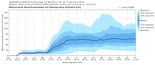 |
| The graph shows a computer model of summed-up amounts of fresh snow with appropriate leeway. Between Monday 31.01 and Wednesday 02.02, winter will return (region: western Lechtal Alps) |
 |
| Wind forecast for Sunday, 30.01: storm! |
What is important for us avalanche forecasters before such rounds of snowfall get underway is the most precise possible analysis of the current snowpack layering. What makes that problematic currently: surface layers, e.g. the encrusted surface hoar layers and faceted crystals beneath them which we described above. Or else snowpack surfaces far removed from wind impact which are expansively metamorphosed (of deformed and faceted crystals) or else “burled powder.”
 |
| “Burled powder” in Jamtal (photo: 25.01.2022) |
Due to increasingly stormy conditions in the mountains, the snowpack surface can become irregular and more varied, which is actually an advantage. Large-area avalanche releases would become less likely. It is also calming that the old snowpack is so stable. This is especially the case on steep sunny slopes, but is also found on shady slopes (where potential weak layers snow no tendenc towards fracture propagation). Also, near the embedded melt-freeze crusts there were no malignant developments evident, e.g. dp-4 (cold on warm) observed.
For further details on ongoing developments and latest forecasts, a special blog will be published at latest on Monday, 31.01.2022.


