Snowpack with few tensions
Snowpack analysis and reports from the field reveal that the snowpack is generally low in tensions in the interim. For that reason this blog will deal primarily with the positive aspects of the situation. On shady slopes there is powder for skiing widespread, while on sunny slopes at least up to intermediate altitudes there are firn-like conditions in many places.
 |
| Loose, expansively metamorphosed snowpack surface, just like powder, especially on north-facing slopes. Tux Alps (photo: 03.03.2022) |
 |
| Powder snow in Arlberg region (photo: 27.02.2022) |
 |
| Corn snow in sunny terrain at intermediate altitude. Tux Alps (photo: 03.03.2022) |
Many winter sports enthusiasts have been observed in backcountry during this period of beautiful weather.
 |
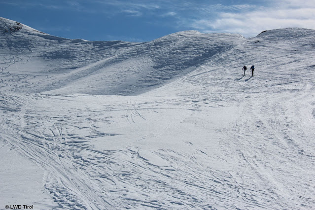
| A frequent sight: heavily tracked snow in popular backcountry skiing zones. Tux Alps (photo: 03.03.2022) |
Few danger zones
Currently we assume that there are only few avalanche prone locations in outlying terrain, where avalanches can be triggered and skiers/boarders are in danger.
The persistent weak layer so often spoken about in recent blogs, caused by weak layers at mid-level in the snowpack, is now limited to the following:
- mostly above 2400m
- triggering possible in very steep, more likely in extremely steep terrain
- triggering most likely where snow is shallow and in transitions from shallow to deep snow in the vicinity of so-called nests of depth hoar
- terrain hardly touched/tracked during the winter
- increasingly on north-facing slopes; in high-alpine regions (above 3000m) also on sunny slopes in isolated cases
The avalanches which trigger are frequently medium-sized.
 |
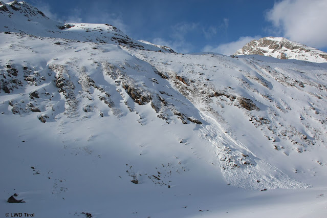
| One person was injured in this slab avalanche in Rettenbachtal on 24.02.2022. (photo: 25.02.2022) |
 |
| Profile from above avalanche in Rettenbachtal. Upper part of the snowpack in “bright white” - lower part in “flat white.” The lower part is expansively metamorphosed to a high degree (nests of depth hoar). Where this layer is blanketed by a slab of sufficient size, a fracture could be initiated. (photo: 25.02.2022) |
In addition, we assume that in a narrow altitude band around 2600m in very steep sunny terrain, due to Danger Pattern 4 (cold on warm) there is a thin, faceted layer beneath the snow which fell (and was transported) on 25.02 and 26.02. An avalanche near Prager Hütte (Venediger Massif) on 28.02 on a steep (at least 35°) west-facing slope at 2600m and another at Schrimmennieder (northern Stubai Alps), likely on 02.03 on an equally steep west-facing slope at 2650m, were probably unleashed in this layer.
 |
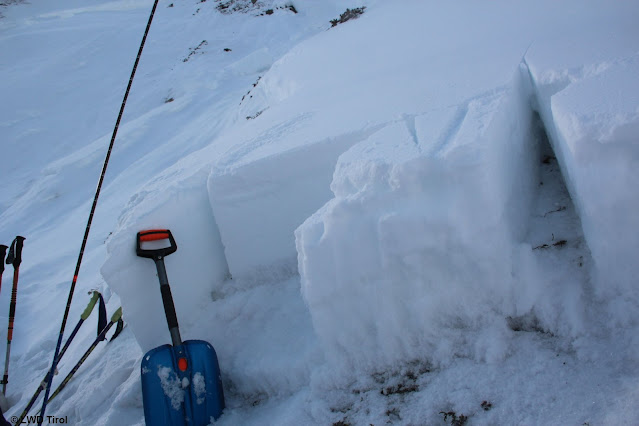
| About 2500m, SW, 40°, Tux Alps. A thin, faceted layer near the surface which probably formed as of 26.02. Profile taken on 03.03 in Tux Alps. |
The snow which fell on 25-26 February was transported by cold NE winds. The snowdrift accumulations can still be easily identified in outlying terrain.
 |
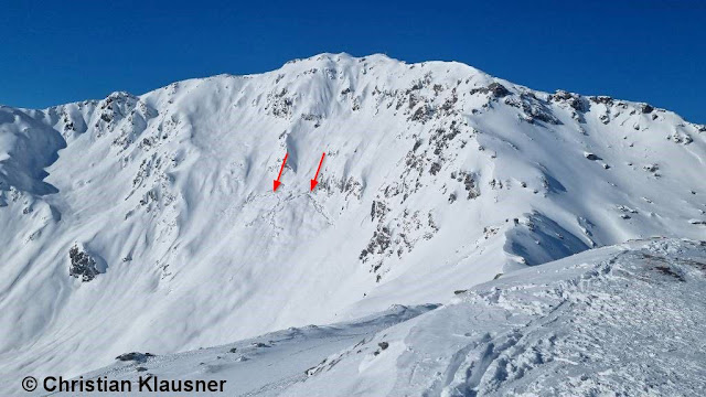
| Avalanche Schrimmennieder (photo: 03.03.2022) |
Isolated “cold” glide-snow avalanches also released last week. One of them caught a person on his way to Namloser Wetterspitze, another led to an exploratory flight to the southern flank of the Nockspitze. Today (03.03) daytime warmth and, even more, moistness of the snowpack seem to have led to more extensive “warm” glide-snow avalanches on very steep sunny slopes at intermediate altitude.
 |
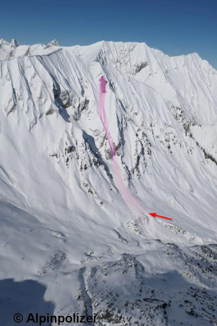
| A glide-snow avalanche that triggered on Egger Muttekopf and partially buried a backcountry skier ascending to Namloser Wetterspitze (eastern Lechtalers Alps). (photo: 27.02.2022) |
 |
| This glide-snow avalanche below the Nockspitze (northern Stubai Alps) led to an avalanche rescue operation due to an entry track which could not be found below the avalanche. (photo: 02.03.2022) |
 |
| Caution urged towards glide-cracks and “wishbones” on the surface. As moistening increases, the likelihood of a release rises. (photo: 28.02.2022) |
Short weather review
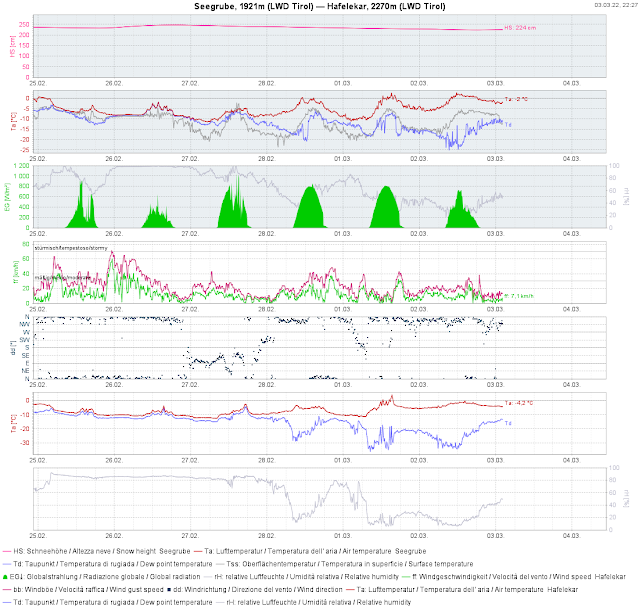
Last week there was snowfall on 25 and 26 February, mostly 10 cm, up to 30 cm from place to place. Due to the low temperatures the snow was rather loose and was transported by quite strong N/E winds. All in all, high-pressure front conditions dominated. The snowpack cooled off well during the nocturnal hours. Due to the low temperatures and very dry air masses the snowpack never became thoroughly wet, simply superficially moist on sunny slopes up to intermediate altitudes.
 |
| 24-hr snow depth difference from 25.02 to 26.02 |
 |
| Weather review seen from Seegrube weather station. Note: the snowpack surface in this flat measuring zone never became moist. |
What we can expect...
According to ZAMG Weather Service, no significant snowfall is anticipated in the immediate future. Temperatures are too low for this juncture of the season. The weekend promises lots of sunshine.
Thus, we can count on a predominantly favourable avalanche situation for a while yet.


