Increasingly weakened snowpack due to water seepage
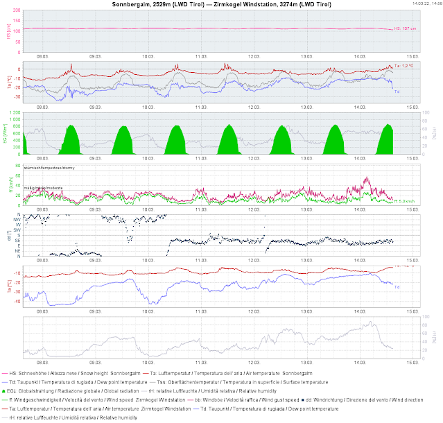
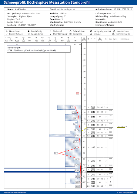
The time window of nearly perfect conditions and low avalanche danger, for the moment, is over. Springtime is making itself felt. That means the snowpack is becoming moister by the day, due to rising temperatures, increasing air moisture and solar radiation (sometimes diffuse). This process is still heavily dependent on aspect, altitude and gradient. Quite indicatively, small changes in the weather are generating huge effects in avalanche danger levels. According to ZAMG Weather Service forecasts, tomorrow (Tues. 15.03) and day after tomorrow (Wed. 16.03) will get intermediate-to-high altitude layers of cloud to start with and subsequently more longwave outgoing radiation. In short: the snowpack can become superficially moistened and thereby weakened very quickly (in some circumstances also on shady slopes down to intermediate altitudes). This can be properly assessed only on-site in outlying terrain, but the weather station data is helpful, particularly a glance at the surface temperature and the thawing point.
 |
| To start with, it keeps getting warmer day by day. Temperature at various altitudes from Sunday 13.03 til Thursday 17.03.2022. |
What makes this situation worse is that during the nocturnal hours on 14-15.03 the anticipated sand/dust from the Sahara will arrive, which will heighten outgoing radiation.
 |
| Sahara dust moving northwards from the south |
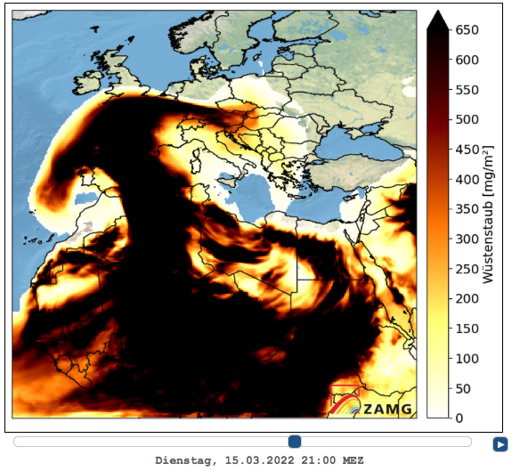 |
| The overload in the atmosphere from Sahara dust will increase during the course of the day. |
Wet-snow avalanches beginning to stir
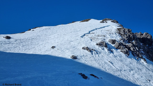
Since the weekend, isolated reports of wet-snow avalanches have arrived at headquarters. These were nearly all small-sized avalanches, most were loose-snow avalanches, some were slab and glide-snow avalanches. Today (14.03) a small slab avalanche triggered during the descent of 3 winter sports enthusiasts from the ski area Sölden towards Winterstall (Vent valley) in outlying terrain and subsequently developed to a dangerously large-sized wet-snow avalanche. In other words...small cause, big effect.
-> This is what needs to be kept in mind over the next few days.
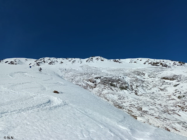 |
| Avalanche Winterstall on 14.03.2022. Shallow snowpack, released down to the ground. SE, about 35° |
 |
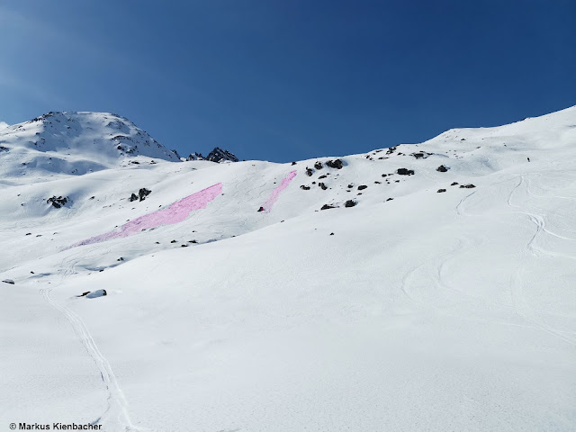
| One person skied orographically left into the slope on 13.03. Shallow-snow zone is visible. This person was swept along by the slab and injured slightly. Schafkar, 2300m, SE, 35-40°. |
 |
| Small moist/wet slab avalanche Rifflsee / Pitztal (photo: 12.03.2022) |
 |
| Small slab avalanche on 14.03. Lampsenspitze, northern Stubai Alps. Entry track is visible. |
Caution: small snowdrift patches on shady slopes, esp.in the classic foehn lanes
During the last few days, a quite strong southerly foehn wind raged. Most struck were the typical foehn lanes, e.g. Wipptal and the bordering regions, once again. The loose snow on expansively metamorphosed (faceted) shady slopes was transported, and subsequently deposited precisely atop this weak layer in wind protected zones. Mostly small but very prone-to-triggering snowdrift accumulations were generated. The danger of falling outweighed the danger of being buried, for the most part. Nevertheless: such danger zones are still prone to triggering, though they are easy to recognize with adequate experience.
 |
| Small snowdrift masses in Wattertal, Tux Alps (photo: 11.03.2022) |
 |
| When southerly foehn wind is blowing, this is one of the most vulnerable spots in Tirol - Patscherkofel |
Our appeal: please heed the daytime cycle of avalanche danger and the nighttime outgoing radiation of the snowpack.
What seems most important is this: grasping the time of day and its effect on avalanche danger. The clearer the skies, the lower the temperature, the drier the air, the more favorable the situation during the early morning hours. On the other side, and that is what counts in the next few days: the higher the temperature, the moister the air (i.e. the more cloud cover during the night), the more unfavorable are conditions during the early morning hours. Avalanche danger then increases very swiftly during the course of the day. Good backcountry tour planning and allotment of time are the keys to success during the coming days.
