In just two days, 8 persons lost their lives in three avalanche accidents. One accident occurred on Fliesser Berg in the Samnaun Massif (5 dead), one occurred near the Breiteggspitze in the western Kitzbühel Alps (2 dead) and one occurred near the Gammerspitze in Schmirntal in the northern Zillertal Alps (1 dead). Today we analysed all three accidents with the help of the Alpine Police. The bottom line: behind all 3 avalanche accidents lay a persistent weak layer near the old snowpack surface as it existed up to 30.01.
Avalanche accident Fliesser Berg on 04.02.2022 (5 dead)
A group of 6 persons was descending in moderately steep, rolling terrain in a bowl east of Fliesser Berg. They maintained ample distance from each other. In a flattish zone the skier at the head noticed that a large slab avalanche triggered orographically to the right. The skiers tried to rush out of the avalanche path, but no one succeeded. All persons were completely buried in snow. One person managed to free his hand and head and then to alarm the rescue operation on his cell phone. That person was the only one who survived.
 |
| Large slab avalanche below Fliesser Berg. Arrows symbolize the descent direction. Red circles depict approximate points of burial of the persons who died; blue circle that of the one person who survived. (photo: 05.02.2022) |
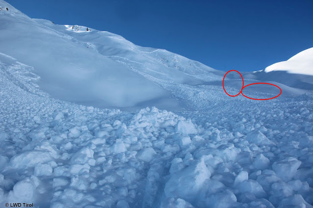 |
| Encircled zones: descending ski tracks. In the spot where photo was taken, the avalanche was first noticed by the descending group. (photo: 05.02.2022) |
 |
Huge avalanche wedge. Arrow points to flattish zone, the spot where the above photo was taken.
(photo: 05.02.2022) |
 |
| View from avalanche wedge towards Fliesser Alpe (photo: 05.02.2022) |
We dug snow profiles at two different spots and also carried out stability tests. The weak layer consisted of faceted crystals which were embedded between two thin crusts. This ‘crust sandwich’ also explains the extensive propagation of the fracture. It can be assumed that the slab first triggered into the sector of terrain just above the flattish zone referred to above. Then the fracture propagated laterally to each side.
 |
| Snow profile orographically left of the lowermost avalanche deposit in 10° gradient at 2080m, East. Easily visible is the weak layer of faceted crystals which lies embedded between two melt-freeze crusts. Atop that is the snow which fell after 31.01. High proneness to triggering. |
 |
| Similar profile near the flattish zone at 24° gradient at 2230m, East. Identical weak layer. Lower proneness to triggering than flatter terrain profile. |
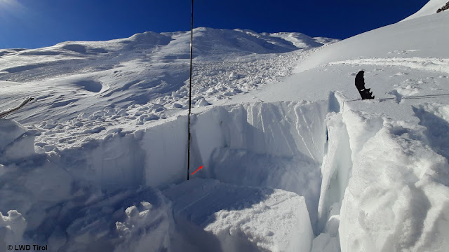 |
| Snow profile location 2080m. Arrow points to weak layer. Note the color contrast between fresh snow (pale white) and old snow (darker). |
Comparison of the two profiles orographically left of the avalanche shows that the profile taken in the same aspect in flattish terrain was more prone to triggering than that in steep terrain. This can be explained by the thicker melt-freeze crust which was generated over the faceted layer in steep terrain due to higher solar radiation.
The persistent weak layer is complex, dependent on aspect, altitude and steepness gradient.
Avalanche accident Breiteggspitze on 04.02.2022 (2 dead)
After a married couple reached the summit of the Breiteggspitze in the western Kitzbühel Alps on 04.02.2022, they skied into an extremely steep, partially wooded west-facing slope slope south of the summit. A slab avalanche triggered and buried both persons completely. After a missing-persons report was filed, the persons were sought and, during the nighttime hours, found lifeless in the snow.
 |
| Slab avalanche Breiteggspitze (magenta) with entry track (arrow). The blue-shaded avalanche is a secondary release. (photo: 05.02.2022) |
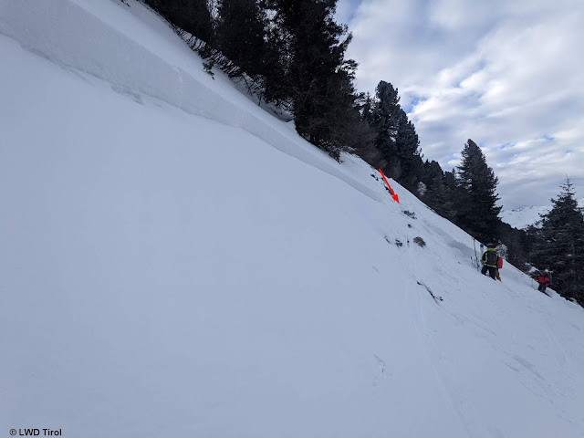 |
| The extremely steep accident slope. Picture of avalanche fracture. Arrow points to entry track. Transition from shallow to deep snow. (photo: 05.02.2022) |
 |
| Avalanche slope with point of burial (photo: 05.02.2022) |
The snow profile taken at the avalanche fracture point reveals the selfsame picture: weak layer of faceted crystals beneath a thin melt-freeze crust. On top of that lay the fresh snow from the latest period of precipitation.
 |
| The weak layer which was relevant to the avalanche lies at the nearly horizontal snow-saw. To the right, the crust is easily visible. Another crust lies below it. (photo: 05.02.2022) |
Avalanche accident Gammerspitze on 05.02.2022 (1 dead)
A backcountry touring group of 5 persons was ascending towards the Gammerspitze in the northern Zillertal Alps. The ascent led through sparsely wooded, very steep forest terrain. Suddenly, far above the group, a large slab avalanche was (probably remotely) triggered. All persons were caught, swept away and buried. Result: one person died, two others were injured.
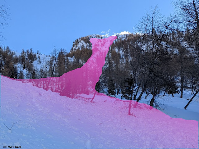 |
| The avalanche triggered far above the group in shady, extremely steep terrain. (photo: 05.02.2022) |
 |
| At the avalanche fracture point. (photo: 05.02.2022) |
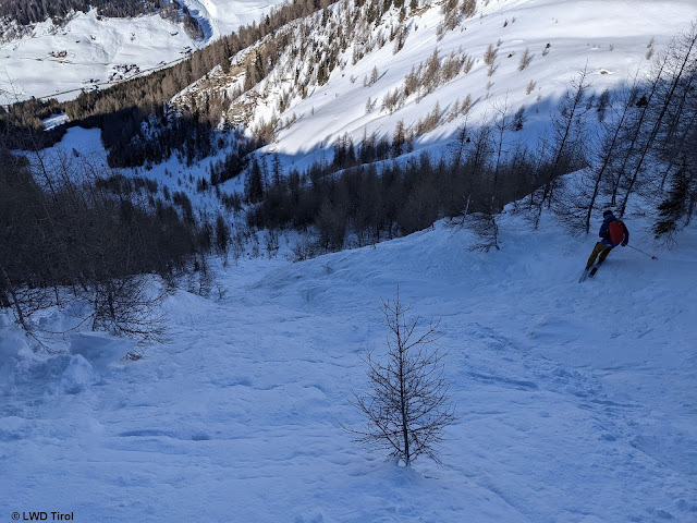 |
| Plummet path (photo: 05.02.2022) |
 |
| Location of one injured person (photo: 05.02.2022) |
The huge fracture propagation can be explained only by a correspondingly extensive persistent weak layer and a correspondingly large slab. The accident zone was among the regions where recent snowfall was heaviest during the latest round of precipitation. Thus, the combination of abundant fresh snow, strong winds and higher temperatures leads one to conclude that the slab was large. The weak layer was identified: once again, faceted crystals beneath a melt-freeze crust. Further snow profiles of the accident avalanches will soon be published
here:


