After a roller-coaster week, winter draws nearer
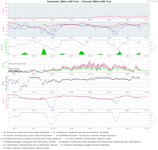
Highly variable conditions have prevailed during the last week. Repeated bouts of rainfall or snowfall occurred The snowfall level lay between 2000 and 2800 m. At high altitude, the winds intensified measurably, blowing from westerly directions.
 |
| Example of variable weather conditions at the Nachtweide-Palinkopf station (Silvretta Group) |
 |
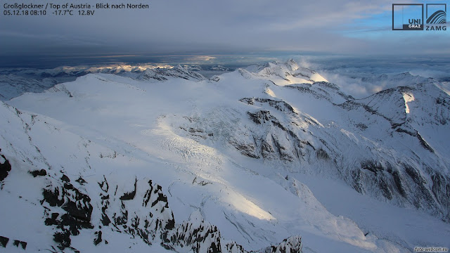
| Alternating sunshine and clouds on the Grossglockner |
 |
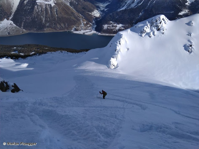
| Most of the snow fell in the western regions, e.g. here in the vicinity of Nauders (Photo: 03.12.2018) |
 |
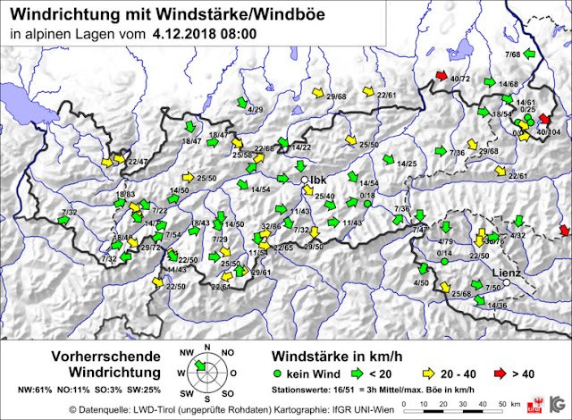
| Wind map of 04.12.2018; winds were blowing predominantly from the west |
The high-altitude powder snow referred to in the last blog became a
rarity as a consequence of the wind. The snowpack surface turned
erratic, and the frequency of snowdrift accumulations increased
incrementally. These snowdrift accumulations were generally small-sized,
but in isolated cases could be triggered by large additional loading.
 |
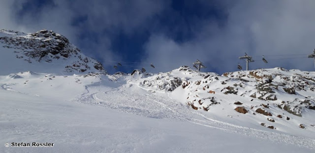
| A skier triggered a small mass of drifted snow on the Stubai Glacier The
weak layer was the covered powder snow. (Photo: 03.12.2018) |
 |
| A heavily wind-impacted snowpack surface on the Rettenbachferner glacier (Photo: 05.12.2018) |
The current situation in North and East Tirol permits backcountry skiing
tours only to a very limited degree. Most of the snow which has fallen
was deposited on the Main Alpine Ridge between the Ötztal Alps and the
Hohe Tauern. A cohesive area-wide snowpack is evident predominantly
above approximately 2200 to 2400 m. In the remaining parts of the land,
there is still not enough snow for skiing tours in outlying terrain away
from secured and marked ski runs.
 |
| The snow situation along the Main Alpine Ridge above approximately 2200 to 2400 m is quite good... |
 |
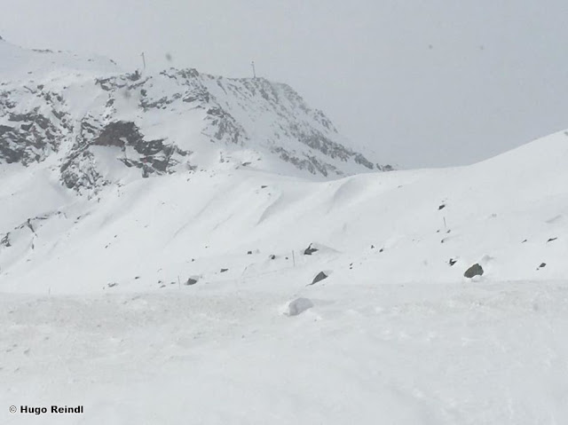
| ...but away from the Main Alpine Ridge there is still only a little snow, like here in East Tirol (Photo: 04.12.2018) |
Particularly where as a consequence of the intensive precipitation at the end of October there was a large amount of snowfall, a solid snowpack base is evident. Crusts and unbonded weak layers are found only near the upper surface, by and large. Whereas in other regions the snowpack is often unfavourably layered due to the shallow snow and the faceted snow crystals generated by expansive metamorphosis, leading to pronounced weak layers.
 |
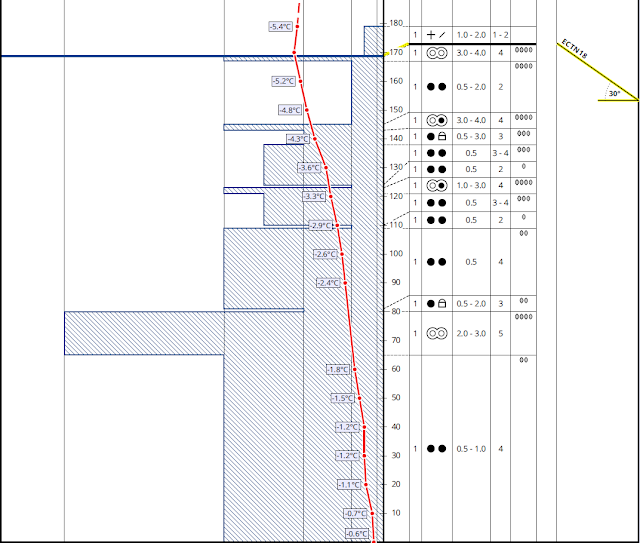
| Snow profile Vordere Schwenzerspitz in the Gurgler Group from
05.12.2018; west, 2800m, 30°. A compact snow base with a few crusts in
the upper part of the snowpack. All in all, a very solid structure for
future loading in the form of fresh snow (© Nicolas Metz). |
 |
| Snow profile on Hoarberger Kar in the eastern Tux Alps from 02.12.2018;
north, 2400m, 30°. A snow profile distinguished by ongoing switches of
warm and cold: the crusts were formed through the impact of high
temperatures and rain. During clear, cold days and nights, the expansive
metamorphosis generated weak layers at ground level between the crusts.
To date, a relevant amount of snow is still lacking to form a “slab”
for the triggering of a slab avalanche. (© Florian Wechselberger). |
What happens next?
On Friday night, a cold front will reach us from the northwest which will be accompanied by storm-strength winds and bring the first snowfall. The snowfall level will drop to nearly 1000 m. In the following days, snowfall over widespread areas will spread throughout Tirol, with steadily dropping snowfall levels. The major area of precipitation will be in the typical northern barrier zones. In East Tirol, especially in the southern parts, significantly less snowfall is anticipated.
As a result of snowfall and wind, the avalanche danger levels will increase over widespread areas.
 |
| Fresh snow forecast until Tuesday morning, 11 December |
