Precipitation this last week has been unusual. The consequence: above average snow depths for this juncture of the season.
 |
| “A Winter Wonderland” at the Dolomiten Hut in the Lienz Dolomites. (Photo: 18.11.2019) |
 |
| At low and intermediate altitudes, massive rain impact on the snowpack. Stubai Alps (Photo: 20.11.2019) |
 |
| The heavy snow burden caused much tree breakage and toppling. This danger is still a threat. In the photo: a recently toppled tree in southern East Tirol (Photo: 20.11.2019) |
 |
| The snowfall was accompanied by storm-strength winds. Stubai Alps. (Photo: 18.11.2019) |
Avalanche danger diminishing
During the last few days, avalanche dangers have decreased incrementally. In the interim, generally moderate danger prevails in the regions where precipitation was heaviest; in the northern regions, low danger.
Main peril: gliding snow
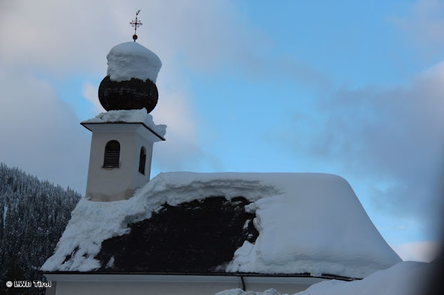
Most caution is still needed towards glide-snow slides and glide-snow avalanches on steep, smooth surfaces. Most of the threat is on grass-covered slopes. However, also below house roofs there is a hidden risk of gliding snow masses.
 |
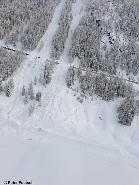
| During the last few days in the regions of Tirol where precipitation was heaviest, numerous glide-snow avalanches have released. Glockner region (Photo: 21.11.2019) |
 |
| Snow masses gliding off a roof can endanger people. Southern East Tirol (Photo: 20.11.2019) |
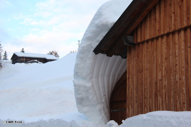 |
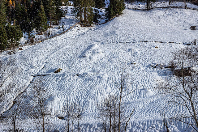
| The snow glides...and malforms. Obertilliach (Photo: 20.11.2019) |
The apogee of glide-snow avalanches has passed. Nevertheless, at very least where glide cracks have opened in the snowpack surface, snow can still glide away as a single mass. Therefore, we advise avoiding all spots below glide cracks in the snowpack. Caution is also urged on tours through narrow valley zones flanked by grass-covered slopes, including above the treeline (where the risk is not visible).
Snowpack layering is mostly stable. Caution esp. on shady, high-altitude slopes near ridgelines.
Our picture of current snowpack layering in the land is becoming ever sharper, thanks to explorations in outlying terrain and extremely good observer reports. Snowpack analysis results in the following:
The snow cover has settled increasingly over the last few days, and stabilized.
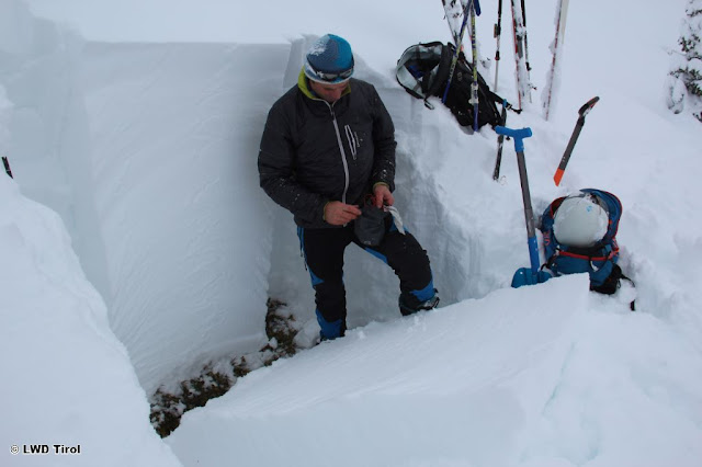 |
| Snowpack analysis at 2100 m, NW in northern East Tirol. Compact snow cover without weak layers. (Photo: 21.11.2019) |
Weak layers inside the snowpack are now found only at high altitudes, starting at about 2400 m. At those altitudes, it is important to distinguish between surface-level weak layers and ground-level weak layers.
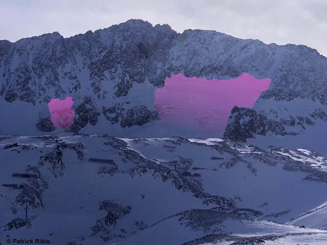
Near to the surface there is powder, often wind-whipped. Due to the stronger winds at high altitude, these danger zones are ever more frequent. Caution urged esp. on very steep, shady slopes near ridgelines.
Near the ground, particularly in glaciated terrain, there are potential weak layers, but in all likelihood these are no longer triggerable by skiers and freeriders.
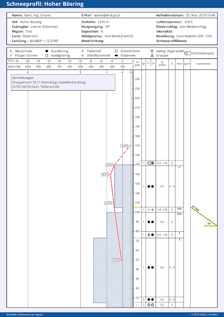
The decisive factor for gliding-snow activity is the moist snowpack at the ground, at least above 2500 m. At low and intermediate altitudes, the snowpack is mostly isotherm, i.e. thoroughly at 0 degrees C.
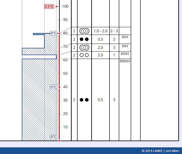 |
| The red line shows the temperature range inside the snowpack: isotherm. Location: Kals, 1530 m, SE, 30 degrees. |
Outlook
The forecast is for higher temperatures. Thus, the snow melting process can raise the frequency of glide-snow avalanches for a short time.
In the heights, trigger-sensitive snowdrift accumulations will be generated increasingly by strong and further intensifying SW winds. For trained skiers and freeriders, they will be easily recognizable and dangerous only for a brief spell.
All in all, quite favourable conditions prevail for skiers and freeriders, as long as one keeps an eye on the gliding snow problem.
