Snowpack becoming moister
With clouds moving in during the night of 14.04-15.04, the snowpack will not cool down during the nocturnal hours. Particularly in an altitude belt around 2300m the moistness will then sink down to deeper layers which have been dry until now. Thereby, the snowpack will lose firmness. The likelihood of moist or wet snow slides, primarily triggered by winter sports enthusiasts, in isolated cases also naturally triggered, thus increases.
.png) |
| Even at 3000m the snowpack was superficially moist where the profile was made (Glacier Ski Area Sölden, 14.04 late evening). |
Caution urged particularly where diffuse radiation leads locally to intensified energy seepage and thereby reinforces the melting process. It is clear that snow quality is currently deteriorating.
.jpg) |
| Glide cracks in the snowpack as red flags of potential glide-snow avalanches. As more water seeps into the snowpack, the likelihood of a release increases. (photo: 12.04.2022) |
Diminishing persistent weak layer
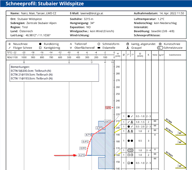
In our last last Blog we pointed out the development of superficial weak layers above 2600m. This problem has receded in the interim. This applies currently most of all to W/NW to N to E/NE aspects. Caution urged especially on very steep to extremely steep slopes where many snowdrift accumulations were deposited last week. This is a problem which is extremely difficult to evaluate and pinpoint. A view into the snowpack down to the area of the colored layer of Sahara dust from mid-March is helpful.
.png) |
| This is a photo of the profile above: upper arrow points to a graupel layer, lower arrow to the layer of Sahara dust from mid-March. The initiated fractures were not completed. (photo: 14.04.2022) |
 |
| Fresh snow forecast from Friday, 08.04 until Sunday 10.04.2022. A pronounced layer of graupel kernels was deposited in many places during this period of precipitation. |
Recent avalanches: triggered exclusively in weak near-surface layers
A few pictures follow of recently reported avalanches in Tirol. What all the releases have in common: weak near-surface layers triggered them due to dp.4 (cold on warm) or dp.9 (graupel).
_bearbeitet.jpg) |
| Western Liebenerspitze, Ötztal Alps, 3200m, SW (photo: 10.04.2022) |
.jpg) |
| Ridgeline slab Wildebene, Arlberg region; 2570m, NW (photo: 11.04.2022) |
.jpg) |
| Slab avalanche on 12.04 near Knotenspitze, northern Stubai Alps. |
_bearbeitet.jpg) |
| Three naturally triggered slab avalanches on 12.04 on Marzellkamm, Ötztal Alps, 2930m-3050m, NE (photo: 13.04.2022) |
What’s next?
.jpg) |
| Abfahrtsgenuss im Gschnitztal (Foto: 12.04.2022) |

.jpg)
