Coolest spring for at least 25 years - Still lots of snow in the mountains
The ZAMG Weather Service recently informed us that spring 2021 is the coolest we have had in the last quarter of a century at least. Similar temperatures prevailed for the last time in 1996 and 1991, a notch cooler still in 1987.
The results are plainly visible in the mountains: winter persists at high altitudes. Potential avalanche problems due to lower-than-average temperatures are still a worry, i.e. near-surface layers. Details can be found in our last blog. Most difficult of all to evaluate is the possible formation of danger pattern “cold-on-warm” (gm.4) and “embedded graupel” (gm.9). We currently assume that these danger patterns tend to be limited to high alpine regions (above 3000m). The greatest probability of dp.4 occurring is on sunny, very steep slopes.
What helps most of all to assess the current situation, in view of the lack of up-to-date snowpack data, are near-surface stability tests you carry out yourself on-site.
A few photographic impressions of the current situation
 |
| Slab avalanche in Grossvenediger region, appx. 3200m SW. Near-surface fracture, danger pattern dp.4 and dp.9 were the likely cause. (photo: 26.05.2021) |
 |
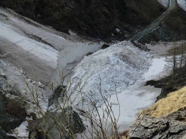
| Deposit of a no longer fresh slab avalanche in Grossvenediger region, N 2600m. Brief period of warmth as possible trigger mechanism. (photo: 21.05.2021) |
 |
Surely the most frequent and easiest to assess: loose-snow avalanches right after snowfall.
(photo: 26.05.2021) |
 |
| Loose-snow avalanches generally trigger naturally, but in extremely steep terrain they can easily be unleashed by winter sports enthusiasts. Northern Stubai Alps (photo: 23.05.2021) |
 |
| Fresh snowdrifts at high altitude. Due to low temperatures a problem at least for a brief spell, particularly near ridgelines on very steep slopes. Grossvenediger region (photo: 26.05.2021) |
 |
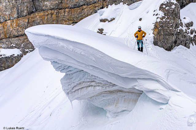
Caution: cornice! Even here, the Sahara dust is clearly visible. (photo: 21.05.2021)
|
 |
| Impressive avalanche deposits and snowplowing efforts in northern East Tirol (photo: 26.05.2021) |
 |
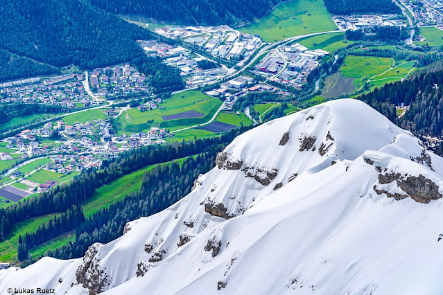
Not an everyday snapshot at the end of May: lush green meadows below, deep winter above.
Northern Stubai Alps (photo: 21.05.2021) |
 |
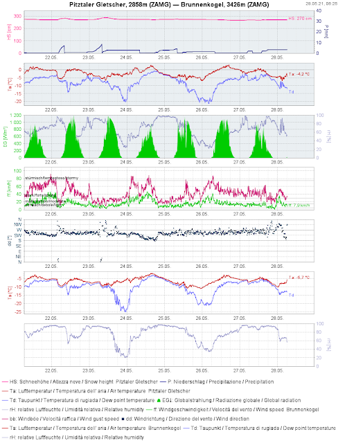
Weather station graphs on Pitztal Glacier corroborate our own gut feeling:
highly variable, cold in the mountains, windy, lots of snow. |
Weather remains variable - Avalanche danger still a concern
Today, Friday 28 May, is a shining exception to the recent norm: pleasant weather. However, the cool, variable conditions have not departed, they will be with us during the coming days.
 |
| Comparatively lots of sunshine, but only today, 28.05.2021... (c) ZAMG-Weather Service |
And so...in spite of the advanced juncture of the season, attentiveness is still required towards potential avalanche danger in high alpine regions.
Update of this blog: (28.05.2021 - 07:00 Uhr):
The above information about the weather referred to yesterday’s report from ZAMG Weather Service. Today’s has not yet been published. Here is an excerpt from the last valid report of ZAMG Weather Service from 28 May 2021 at 7:00 am:
“Following in the wake of a cold front, intermediate high-pressure front weather conditions will be felt today in Tirol. On the weekend, a northerly air current and a high/low will move from the Baltic Sea towards Hungary. Tirol will receive moderately moist air which particularly in eastern regions will create cloudbanks. Further west, weak high-pressure conditions will prevail. Next week we will lie at the rim of a high-pressure front. Starting on Sunday, we expect several days of dry weather, culminating in early-summer temperatures next week.”
Thus, we anticipate classic springtime conditions and daytime fluctuations of avalanche danger.
The next update of the blog will be published whenever the avalanche situation undergoes a major change.


