...so that residents can better evaluate potential dangers to infrastructure and settlements. Please undertake no mountain or skiing tours!
(FAQ Quarantäneverordnung) Every accident unnecessarily robs the time and energy of rescue services and health system.
Springtime conditions go on...for a bit
Last week was marked by classic springtime conditions, including a slight daytime avalanche danger cycle. In the morning mostly low, in the afternoons mostly moderate danger.
 |
| Brief cloudy phases only on 13.03 and 14.03, regionally on 18.03 during the night. Otherwise brilliant sunshine and very dry air masses. Also highly indicative: daily cycle of snowpack surface temperatures. |
 |
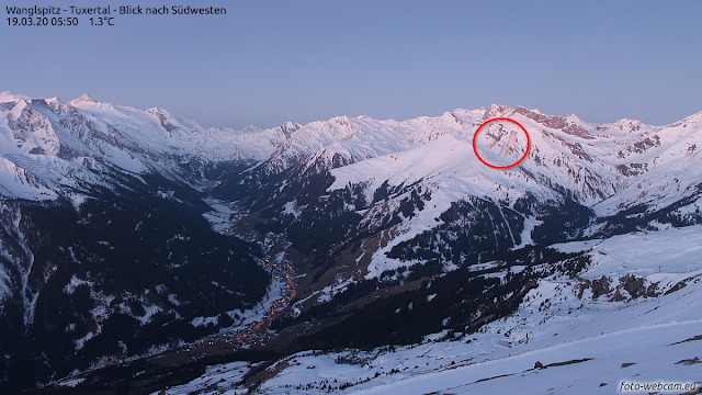
| Conditions improve on Friday afternoon, 13.03. Northern Stubai Alps |
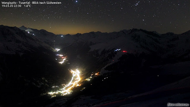 |
| Star-studded nighttime skies and dry air stabilize the snowpack which softened superficially the day before |
Avalanche activity is limited. The main danger stems from isolated glide-snow avalanches on steep grass-covered slopes.
 |
| Glide-snow avalanches caught by foto-webcam.eu |
 |
| Glide-snow avalanche and glide cracks in northern Stubai Alps (photo: 15.03.2020) |
Caution: cornices continue to break...
 |
| ...such as here in Boden, Ausserfern (photo: 18.03.2020) |
Decisive: continuing moistness/wetness of the snowpack
The assessment of avalanche dangers is currently based on only a few snow profiles. What matters most: snow temperature.
 |
| Isotherm snowpack, SE aspect at 2020 m, 26°, on 14.03.2020, northern Stubai Alps |
 |
| Temperature reserves, NE aspect at 2540 m, 36°, Gurgl Group on 15.03.2020 |
 |
| Also currently indicative: frequent sequences of melt-freeze crusts on sunny slopes. Inside the snowpack, frozen meltwater canals are often evident. |
Parallel to this, a simulation program called SNOWPACK also provides deeper understanding. With it we can better evaluate the extent of snowpack moistness/wetness and loss of snowpack firmness.
 |
| This graph shows the simulated water seepage into a fictitious 38° south-facing slopes near the Nachtweide weather station in the Ischgl ski area during the current season. Through a combination of parameters provided by the weather station and the SNOWPACK simulator, it is possible to calculate how much water seeps how deep into the snowpack. Initial wetness is often dependent on heightened wet-snow and glide-snow avalanches. However, below 2200 m and on sunny slopes below 2800 m, the snowpack has been subjected to rainfall and warmth rather frequently this season, thus, the deeper water seepage of the last few days has very little influence on the wet snowpack stability. On shady slopes and at higher altitudes it is a different matter. There, we expect the first simulation of deeply embedded, faceted layers to lead to heightened activity of wet slab avalanches. But that will still take awhile. |
 |
| This running graph shows the stability of the wet snowpack, calculated with the SNOWPACK simulator. Red signatures denote an unstable, wet snowpack. Blue signatures show how deep the snowpack freezes overnight, giving an indication of how thick the melt-freeze crust is. |
The quintessence: a marked wet-snow avalanche cycle is not currently expected, particularly due to the repeated times throughout the winter when the snowpack became thoroughly wet.
As of 21 March, a cold front: temperatures will drop, temporarily end springtime conditions
On Saturday (21.03) a weak cold front will bring a small amount of fresh snow. Temperatures will remain down. Wet-snow avalanches are thus unlikely for a time. In accordance with the juncture of the season, caution will then be necessary towards diffuse light conditions and loose-snow avalanches. In addition, isolated glide-snow avalanches continue to be possible.


