After brief delicate situation for winter sports enthusiasts, quite favourable conditions
Last week was marked by superb powder and favourable conditions as well as a delicate avalanche situation for winter sports enthusiasts. This was on Tuesday, 10-11.03 when a warm front passed over Tirol and numerous naturally triggered avalanches released. These were also observed on 11.03 in the morning hours when diffuse radiation impact weakened the snowpack. The following dry air masses and star-studded skies on Wednesday night (11-12.03) improved the situation, and Thursday was hit by classic springtime conditions with a daytime danger cycle.
 |
| Striking: sunny 08.03; warm front on 10.03, initial rise of snow depths, then massive settling due to rain and sun; wet snowpack with outgoing radiation on 11-12.03; a melt-freeze crust forms which can carry loads in places. Snowpack softens as a result. |
Then until 14.03 follow two weak cold fronts. Avalanche science points to potential glide-snow avalanches on steep grass-covered slopes and loose-snow avalanches. In very isolated cases there are recently formed snowdrift masses which can be triggered, particularly on shady slopes above about 2800 m. In addition, the fronts referred to also form small, fresh snowdrift masses. Caution is required most at high altitudes in ridgeline terrain in the western regions of North Tirol, i.e. where precipitation was heaviest.
Impressions from this last week
 |
| A dream day, full of backcountry skiers throughout Tirol: 08.03.2020. Defereggental. |
 |
| Powder in East and North Tirol. Here, descent from Kleinen Kaserer in the Tux Alps. (photo: 08.03.2020) |
 |
| Very steep terrain was also used and skied. Rosskogel, Stubai Alps. (photo: 08.03.2020) |
 |
| Finest very light fresh snow in the Tux Alps. An interesting thing was observed: the skins curled up while the snowpack was still dry. That happens only when the snow is extremely loose, the air very dry and radiation already quite intensive. As a result, due to very high temperature disparities, a weak layer was able to form in the uppermost layers of the snowpack (“radiation recrystallisation”). The prerequisite for this was lacking, due to the ongoing weather development. |
Avalanche releases were few, in view of the many winter sports enthusiasts who were in outlying terrain. Avalanches were generally small-sized. There was also the risk of being swept along. This happened to one climber in the Wilder Kaiser, who was injured.
 |
| Avalanche release Mädelegabel in Ausserfern. (Surface hoar seen here as weak layer, for a short time). (photo: 08.03.2020) |
 |
| Avalanche release Goinger Törl (photo 08.03.2020). Somewhat unclear is the weak layer, possibly a local, briefly relevant dp.4 (cold on warm) adjacent to a ridgeline, shady slope. |
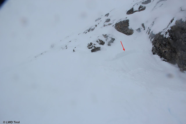
 |
| Near the upper avalanche. Shallow slab near a ridgeline on Kleinen Törl. (photo: 08.03.2020) |
Warm front on 10-11.03
Please refer to the
Blog on 10.03.
The warm fron led to a marked rise in avalanche danger and to high naturally triggered avalanches because the front initially still bore snowfall which transformed to rainfall up to about 2400 m. Thus, a perfect weak layer in the form of cold powder and decomposed crystals existed. The slab formed through the warmth and also through the wind at high altitudes.
 |
| Precipitation on 09.03, then a warm front on 10.03, snow changing to rain |
 |
| Rainfall levels in Tirol at the end of the warm front |
 |
| In steep terrain, shallow fractures could be provoked rather rapidly during the precipitation. This proves the high proneness to triggering. (photo: 10.03.2020) |
In western regions the precipitation was more intensive than expected. The avalanche bulletin was updated for that reason and for 11.03 high danger published for a brief time. High danger (“Ski Tour High”) was also justified for the neighbouring regions in retrospect, where there was more snowfall. Further to the east where there was less precipitation the avalanches were correspondingly smaller. In general, these were superficial slab avalanches and loose-snow avalanches as forecast.
 |
| Avalanche releases in the Silvretta. (photo: 11.03.2020) |
 |
| ...some of which reached ascent paths to refuges. (photo: 11.03.2020) |
 |
| Avalanche releases in Sellraintal. (photo: 11.03.2020) |
 |
| Avalanche deposit in Zillertal. (photo: 11.03.2020) |
 |
| Small loose-snow avalanche in Tux Alps. (photo: 11.03.2020) |
 |
| Successful artificial triggerings. Ötztal. (photo: 11.03.2020) |
 |
| Artificially triggered avalanche in Pitztal. (photo: 11.03.2020) |
Central East Tirol and southern East Tirol were hardly touched by the warm front.
 |
| A freerider was lucky in the Wasserkar (Ötztal): swept along by a slab avalanches and buried. After 10 minutes he was dug out of the snow masses uninjured . (photo: 11.03.2020) |
Rapid stabilisation as a result of improved weather
When loose powder forms a weak layer, it provides a great advantage over persistent weak layers, since the powder swiftly bonds with the snowdrifts deposited on top of it. This is even more the case when solar radiation is intense and/or temperatures are high. Currently, both are the case. For that reason, the snowpack has stabilised very quickly. Avalanche danger receded swiftly, but rose again in the daytime today on 12.03 due to solar radiation and relatively high temperatures. Water which seeped into the snowpack weakened it superficially.
 |
| Impressive shot of water collection zones via photo-working by Lukas Ruetz. (photo: 11.03.2020) |
 |
| A typical profile in sunny steep terrain currently. Sequence of crusts. Isotherm snowpack. No fracture propagation. |
Spring is coming - heed daytime avalanche danger cycle
According to ZAMG Weather Service, following the short weak cold front, a persistent warm period of fine weather will follow as of Sunday 15.03. For winter sports enthusiasts that means: whoever starts out early is doubly rewarded. Avalanche danger conditions are more favourable than later in the day. And with good route planning there is wonderful firn snow to be enjoyed.
Avalanche dangers are expected to be quite recognizable. Attentiveness is required towards the quite large cornices at high altitudes.


