Last week, high-pressure weather conditions were again prevalent, with short pauses (see previous blog). Winter sports enthusiasts usually enjoyed favourable conditions. Good powder could be found especially in regions where there was lots of fresh snow. Elsewhere, snow quality was modest-at-best except in wind-protected, shady zones.
 |
| Once again, superb backcountry touring conditions. On the way to Hochgasser (photo: 20.01.2020) |
S |
| Brilliant sunshine in the Stubai Alps (photo: 22.01.2020) |
Avalanche danger is moderate at high altitudes, at lower altitudes danger is low. Moderate danger is declared because of wind influence and freshly generated snowdrift accumulations. The snowdrift masses are often quite easy to trigger, however they are generally shallow and easy to recognize, especially by experienced backcountry tourers.
 |
| The main danger stems from freshly generated snowdrift masses, frequently on shady slopes. This applies particularly to zones which were wind-protected for longer periods. Naturally triggered slab. Glockturm Massif. (photo: 23.01.2020) |
Weather
Currently, on 23.01, brilliant sunshine reigns throughout the land. Winds have intensified, however, and in some places are blowing above transport velocity.
 |
| Winds were strongest in the classic foehn lanes. |
 |
| Snow transport near the ridgeline. A typical snapshot in many regions along the Main Alpine Ridge. (photo: 23.01.2020) |
 |
| Snow transport was also registered in low lying areas, such as here in Boden, Ausserfern. (photo: 20.01.2020) |
The ZAMG Weather Service wrote about this weather situation: “From the Atlantic over the British Isles and the Alps as far as the Balkans, a powerful high-pressure front is spreading very dry and, at high altitudes, mild air masses. In the valleys the cold air collects. On the weekend this high will weaken, slowly the conditions are expected to change to a westerly air current.”
Snowpack
What matters most for the snowpack are the weak near-surface layers. These are mostly loosely-packed, expansively metamorphosed (faceted) crystals which have been able to persist particularly in wind-protected (inc. shady) zones. But also on west and east-facing slopes there are thin melt-freeze crusts near the uppermost surface. These are only of importance if they get blanketed by fresh, somewhat thicker snowdrift accumulations.
 |
| Visible is the still loose, already faceted snowpack surface, on the one hand, and the thin snowdrift masses on the other. (photo: 23.01.2020) |
 |
| Near-surface profile: loosely-packed snow, beneath that a wind-impacted snowpack. The old snowpack is stable over widespread areas. |
On sunny slopes, on the other hand, melt-freeze crusts predominate, with frozen water columns. Also there, the snowpack is stable by and large.
 |
| Frozen water columns are often found on steep south-facing slopes. (photo: 19.01.2020) |
Disturbing the old snowpack is conceivable in isolated cases on extremely steep, shady slopes where the snow is shallow. And even there, there are encrusted layers of depth hoar frequently evident, in other words, layers which are not particularly weak.
 |
| A photo to match the snow profile above, although upside down. Visible is the hardened wind crust beneath the depth hoar (in the upper photo). The snow crystals of the depth hoar were encrusted in the spot where the profile was made. (photo: 23.01.2020) |
A few other notes about the snowpack surface:
 |
| Frequently observed: a snowpack surface which is heavily wind-impacted. Central East Tirol. (photo: 17.01.2020) |
 |
| Becoming rare: powder snow (more frequent in regions with lots of fresh snow) and “burled powder”. Glockturm Massif. (photo: 23.01.2020) |
 |
| In the Karwendel in the narrow altitude band 1900-2100 m, surface hoar formed where there was a swath of cloud previously. (photo: 22.01.2020) |
Avalanches
The details of the last blog are still applicable. In other words: caution urged especially towards freshly generated snowdrifts.
 |
| Fresh snowdrifts were easily triggerable in Aussefern. (photo: 19.01.2020) |
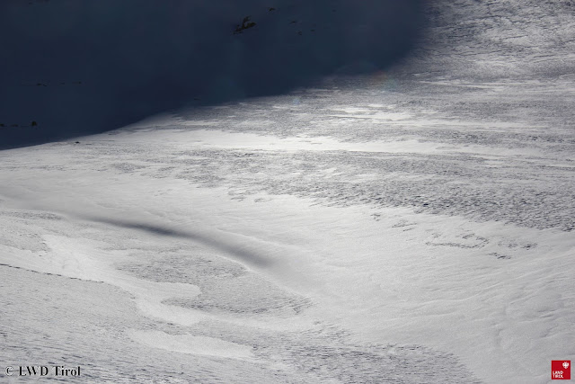
In there regions where recent snowfall was heaviest, harmless loose-snow avalanches were observed.
 |
| Loose-snow avalanches in Hintertux. (photo: 20.01.2020) |
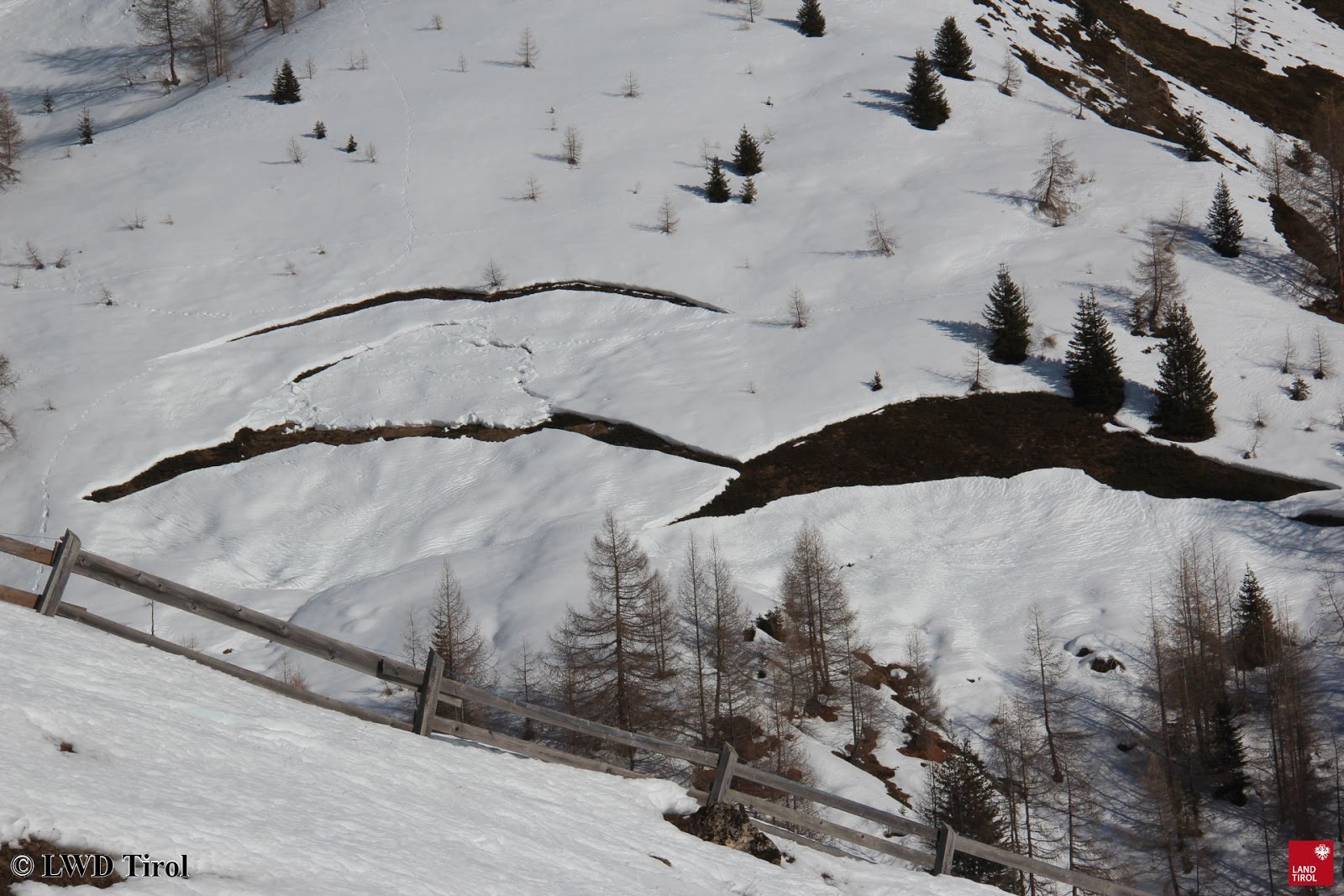
Glide-snow avalanches are being registered only in very isolated cases. Generally, only the glide cracks in the snowpack are visible.
 |
| In principle, ready to trigger but seldom active. Glide-snow slides and avalanches. Samnaun. (photo: 22.01.2020) |
Outlook
No significant change in avalanche danger levels is anticipated. Fresh, easily recognized masses of snowdrift should be avoided whenever possible in steep terrain.