At great heights, caution: small-area snowdrift accumulations, loose-snow avalanches, glide-snow slides on grassy slopes.
Cool temperatures in late September brings snow to high altitudes
Following a warm, summery early September, the latter half was gray, rainy and cool At high altitudes there was frequent snowfall accompanied by strong winds. Some of the precipitation fell as graupel-pebbles.
%20(Large).jpg) |
| Weather in the latter part of September resembled April: variable and cool. Above: a view over Innsbruck towards the Northern Massif. (photo: 27.09.2022) |
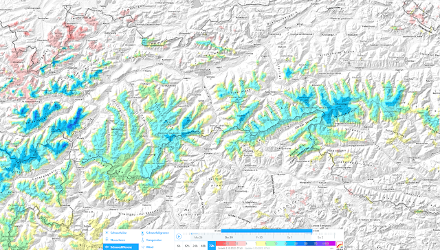
Currently we’re in the grip of a northwesterly air current. The snowfall level has ascended noticeably, now hovering at 2600-2700m. Snow depths are decreasing below that altitude, increasing above it.
 |
| Early September warm, late September cold accompanied by fresh snowfall. Strong winds during the precipitation. Pitztal Glacier |
 |
| At great heights there is already enough snow to launch the glacier skiing season. |
 |
| 72-hour difference in fresh snow. In northwestern regions, snow depths decreased due to weather change. |
Tomorrow (3 October 2022) the NW air current will recede amid dropping temperatures. Only a small amount of snowfall is expected thereafter. A high pressure front will then take over, temperatures will rise and lots of sunshine can be expected.
For a brief spell, mostly small avalanches are on the horizon.
At great heights where there has been frequent snowfall in the last few days, potential avalanche danger requires special heed for a short time. We envision mostly small snowdrift accumulations near ridges in leeward, very steep, high alpine terrain. Caution urged especially towards the danger of being swept along and forced to take a fall. As soon as the the sun comes out again and temperatures rise, we will probably see lots of loose-snow slides. Furthermore, in the few high-altitude zones where there are steep grassy slopes covered by fresh snow, the snowpack can easily glide away over the smooth ground. As we said, this is a short-term problem. Sunshine and higher temperatures will swiftly stabilize the snowpack again (and lots of the snow will melt away).
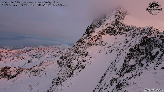
Heightened danger of falling into crevices
The glaciers have had a rough year (again). After a winter with much less snowfall and lots of dust blown up from the Sahara, then followed by an extremely warm summer, the rate of snowmelt was unusually high. On the Pasterze, below the Großglockner, for example, ice melted at two-to-four times the average of the last few years. The ice thickness was reduced by 3.7 cm, according to ZAMG Weather Service.
 |
| Overwhelming loss of mass on the Pasterze Glacier... |
 |
| Numerous open (or barely covered) glacier crevices... (11.08.2022) |
 |
| Some of the glacier crevices are now covered with fresh snow or wind-loaded. That means there is high danger of falling into them. (photo: 28.09.2022) |
Particularly in view of the anticipated increasing crowds of skiers on the glacier ski slopes, we urgently need to point out this problem. One should not venture outside the secured ski areas onto glaciers unless one has the requisite experience and equipment.
The next blog will be published when the snow and avalanche situation in Tirol’s mountains makes it necessary. In the interim, the LWD Tirol team wishes an enjoyable and pleasant autumn to one and all.
