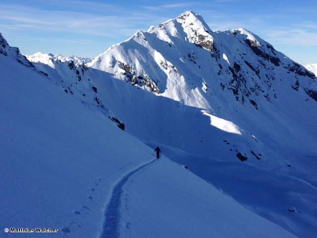
Weak layers in the old snow are currently the main problem for winter sports in Tirol’s mountains.
In East Tirol, separate from the Main Alpine Ridge, the old-snow problem is striking. Due to the shallow snowpack at the end of January, markedly weak layers formed near ground level consisting of faceted snow crystals and depth hoar, and were covered over by fresh snow last week. Between about 1600 m and 2600 m, these weak layers can, in places, be triggered by minimum additional loading, e.g. the weight of one sole skier. Most critical are W-N-E aspects. Due to the depth of the fresh snow, avalanches which fracture in the weak old snow fundment can grow to large size.
In addition, in far-reaching parts of Tirol on south-facing slopes (SE-S-SW) in a narrow altitude band of about 2300-2600 m, we see a weak layer of faceted crystals which developed around a melt-freeze crust in mid-January. In the last few days we have had numerous reports of settling noises and avalanches (see blog of 04.02.) connected to this layer. Prior to the most recent snowfall, this weak layer was quite superficial. In regions where snowfall was heavier, and on slopes which were starkly wind-loaded, the characteristics of the slab, from the point of view of skiers, are less favourable: fractures can propagate far more easily and avalanches can grow to greater magnitude. In East Tirol, this weak layer is part of the weak old-snow fundament.
 |
| In the snow profile depicted above, a stability test provoked a fracture (ECTP2) above the melt-freeze crust from 16 January. (photo: 06.02.2019). |
 |
| The weak layer from mid-January led to numerous naturally triggered avalanches during the precipitation last weekend on south-facing slopes between about 2300 and 2600 m. (photo: 06.02.2019). |
In the Zillertal Alps, Tux Alps and central Stubai Alps a fracture down to more deeply embedded layers of the old snow is still conceivable. Namely, on very steep, shady slopes between about 2300 and 2600 m. It is likely that only large additional loading will trigger one. The avalanche prone locations occur relatively seldom.
Old-snow problems are always treacherous. They lurk inside the snowpack, making avalanche prone locations unrecognizable for backcountry skiers and freeriders. When aspects and altitude zones are pointed out in the Avalanche Bulletin in this connection, we recommend a defensive route selection. Large, steep slopes should be avoided.
The current warm temperatures, which are expected to persist through Sunday (see “Outlook”), will also bring about heightened gliding-snow activity. Due to the depth of the snowpack all the way down to low altitudes, glide-snow avalanches can attain great magnitude. The rule of thumb is: circumvent all zones below glide-snow cracks.
 |
| Winters with lots of snow mean high gliding-snow activity. (photo: 06.02.2019). |
Positive:
In far reaching parts of North Tirol, quite good backcountry touring conditions currently prevail. On south-facing slopes the snow has been strongly affected by the sunshine. On north-facing slopes, however, the loose fresh snow which fell during the cold front on Sunday, 03.02, can be enjoyed to the hilt. The wide-ranging snowdrift accumulations of last week have bonded well with the old snowpack and are unlikely to trigger. In isolated cases, trigger-sensitive snowdrift accumulations are found on shady slopes adjacent to ridgelines at high and high alpine altitudes, but they are generally small.
 |
| Fabulous powder snow on north-facing slopes, as here near the Zittauer Refuge in the Zillertal Alps. (photo: 05.02.2019). |
 |
| In northern East Tirol (above, Venediger Massif) winds were strong in recent days and heavily impacted the snowpack surface. (photo: 06.02.2019). |
Outlook
In the early morning hours of Friday, 08.02, a weak cold front will reach us in whose wake a few centimeters of fresh snow are expected in the northern regions above 800-1200 m. Winds will increase somewhat, thus, fresh snowdrift accumulations will be generated, particularly on shady ridgeline slopes. They will be small but easy to trigger, in some places deposited on top of light-fluffy snow or surface hoar. The avalanche prone locations will be easy to recognize.
 |
| On Friday, snowdrift accumulations will form particularly near ridgelines, most of them small but easily triggered. |
Between Friday, 08.02 and Sunday, 10.02, sunshine and cloudiness will alternate. It will remain relatively mild for this juncture of the season. This intermediate warm period will have a positive effect of stabilizing the snowpack on south-facing slopes: the trigger sensitivity of the weak layer in North Tirol will decrease somewhat due to the effects of warmth and solar radiation. On the other hand, gliding snow activity on steep, grass-covered slopes will increase.
 |
| Gliding snow activity will be heightened over the next few days. Gartalm, eastern Tux Alps. (photo: 06.02.2019). |
On Sunday night, a weather perturbance is anticipated which will bring precipitation, lower temperatures and strong-velocity NW winds. New snowdrift accumulations will be generated, avalanche danger will increase.
The old-snow problem will persist, particularly in East Tirol.
 |
| Through Sunday, 10.02.2019, it will remain unseasonably mild. A weather perturbance will follow, bringing lower temperatures and precipitation. (©meteoblue). |
 |
| On Sunday night, some fresh snow is expected throughout Tirol. |

